
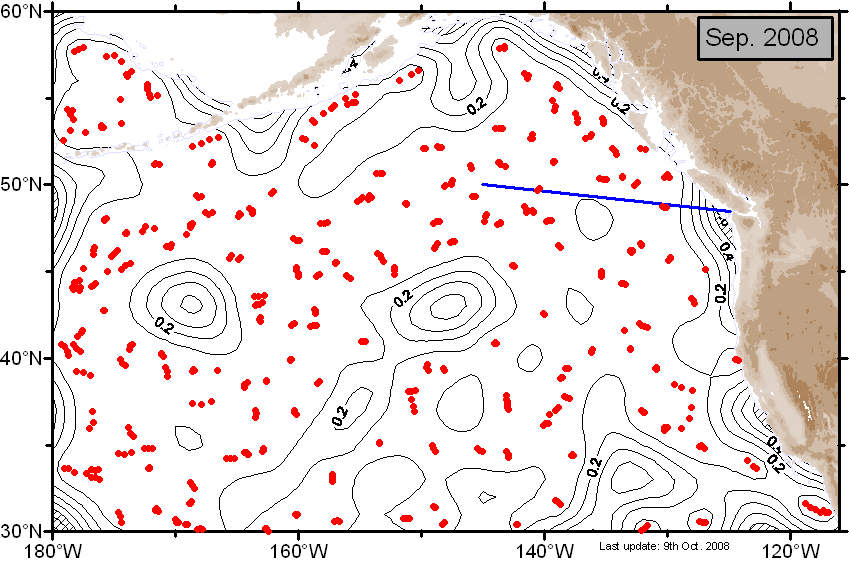
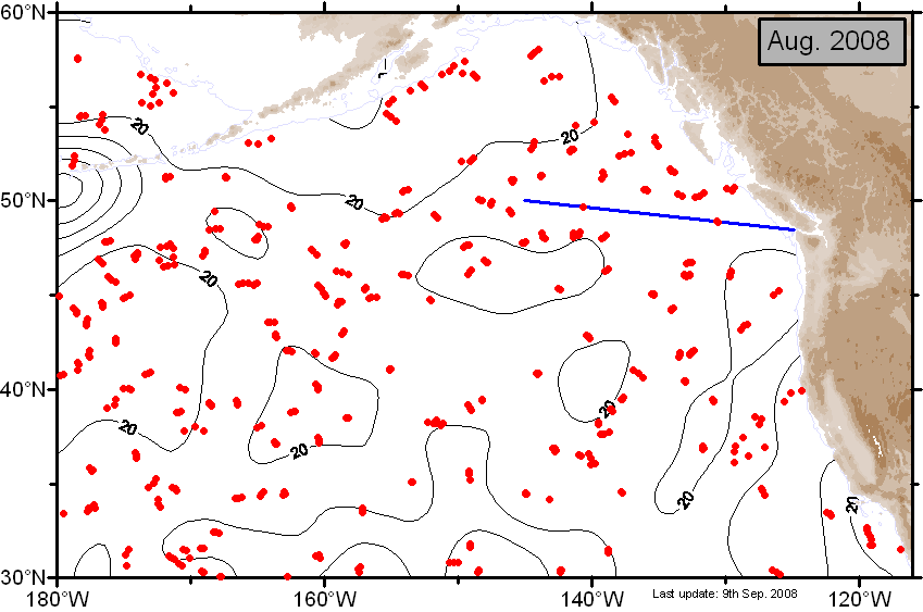
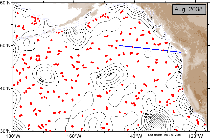
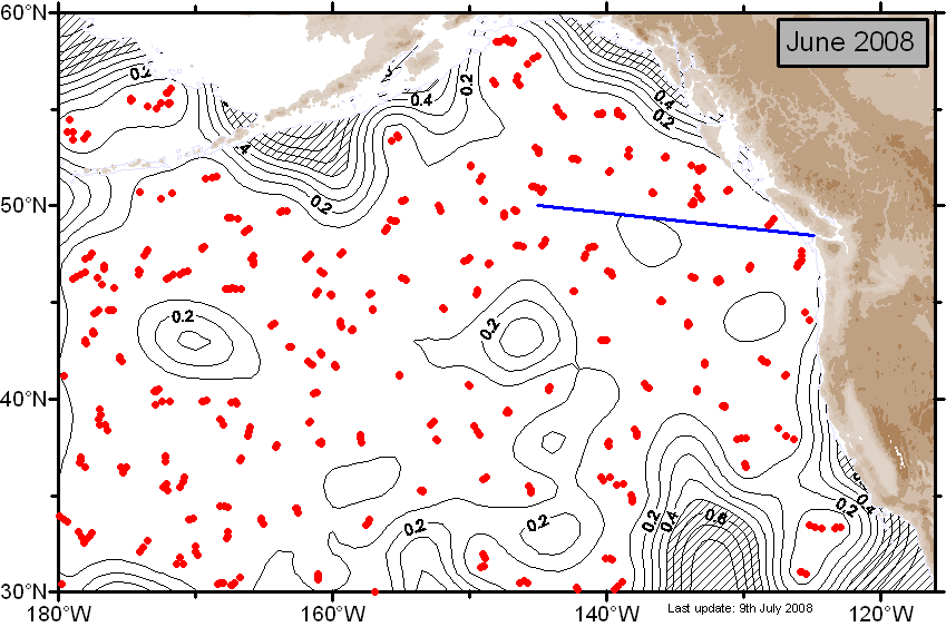
Gulf of Alaska Mixed Layers
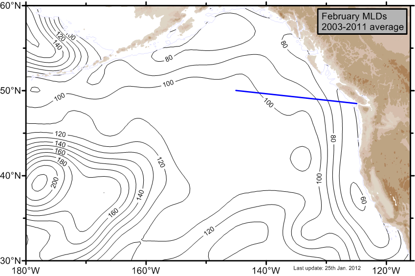
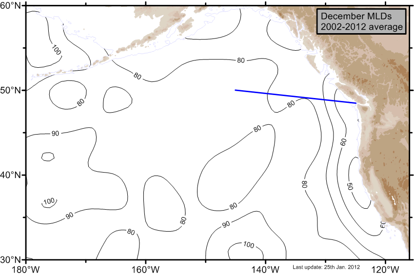
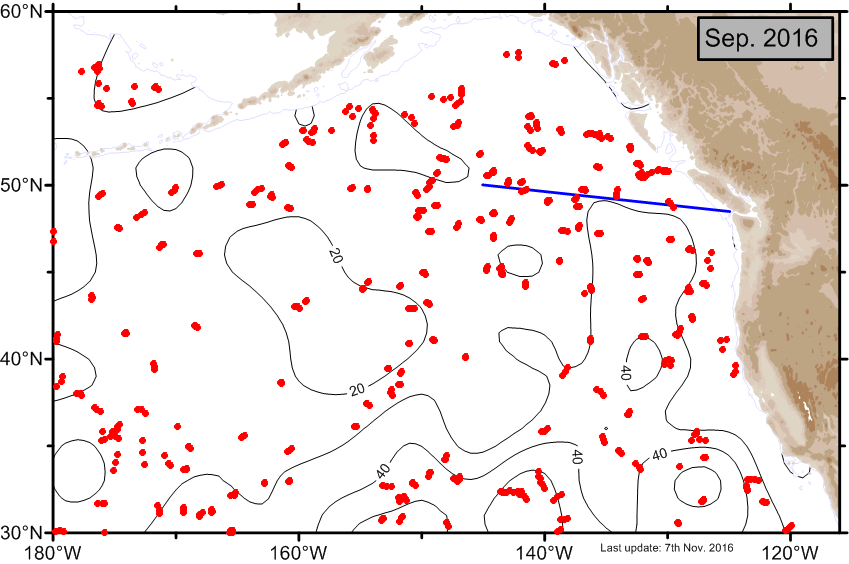
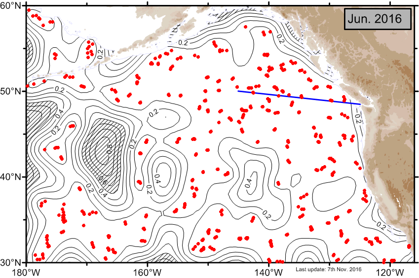
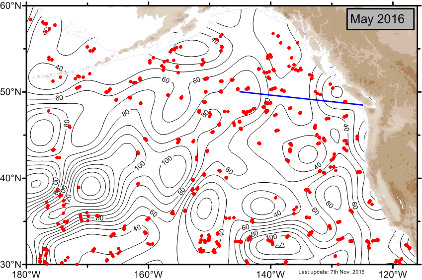
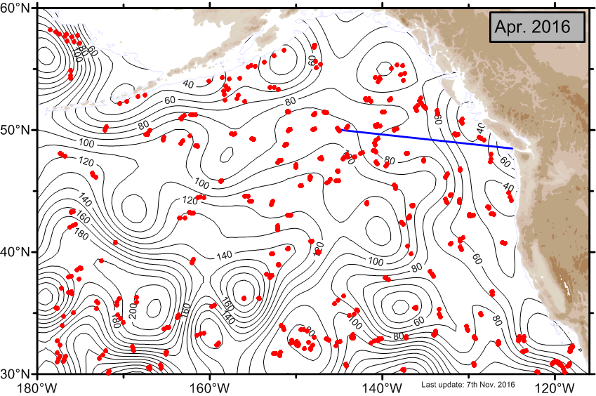
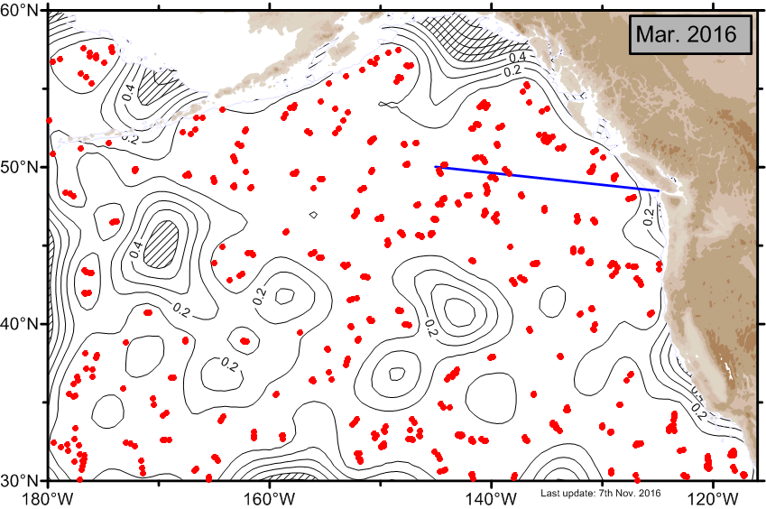
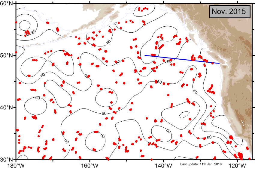
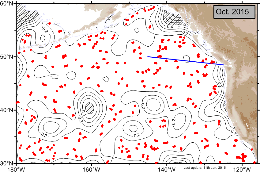
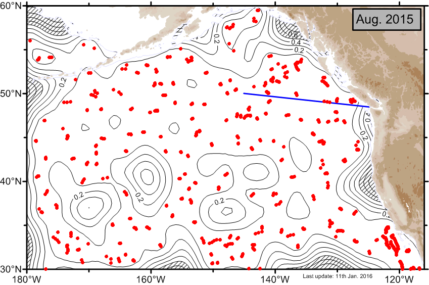
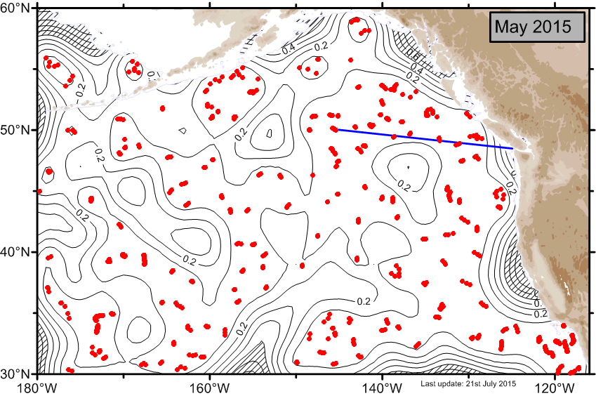
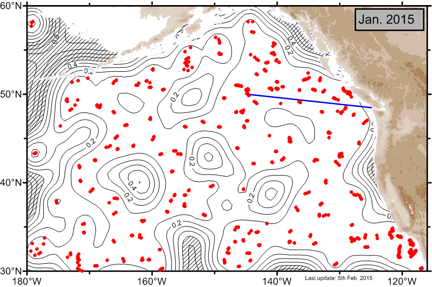
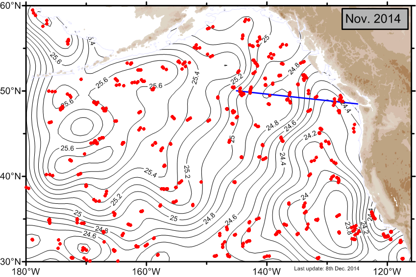
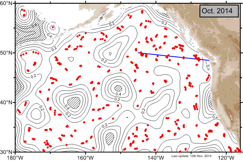
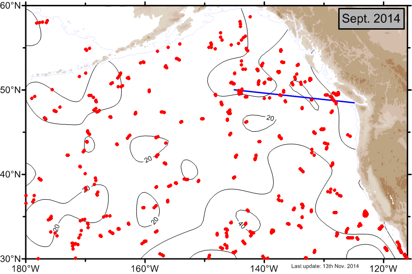
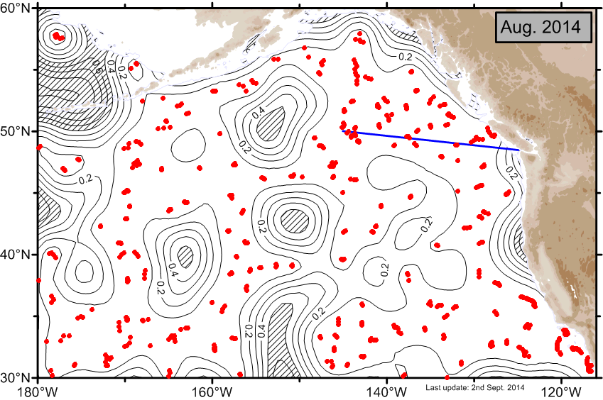
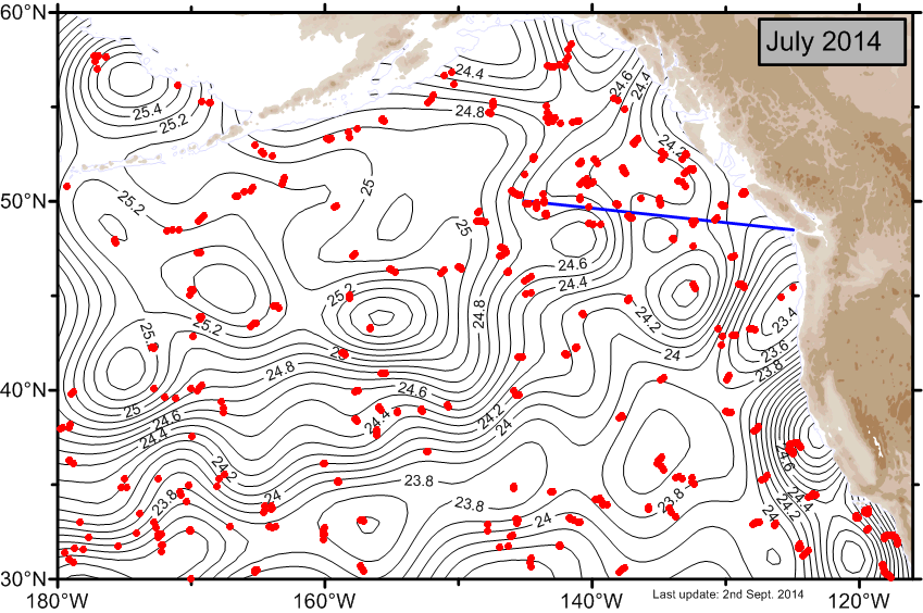
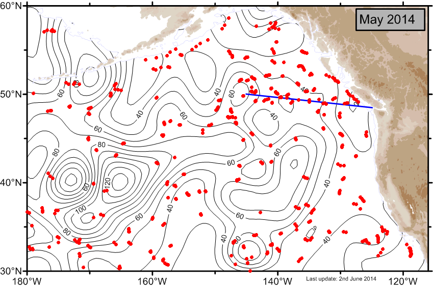
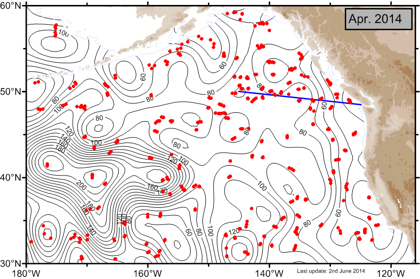
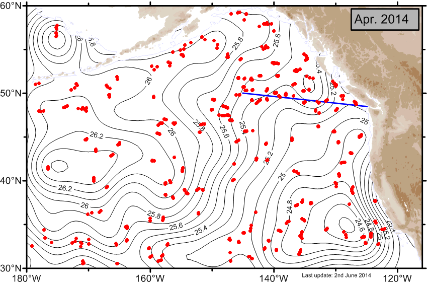
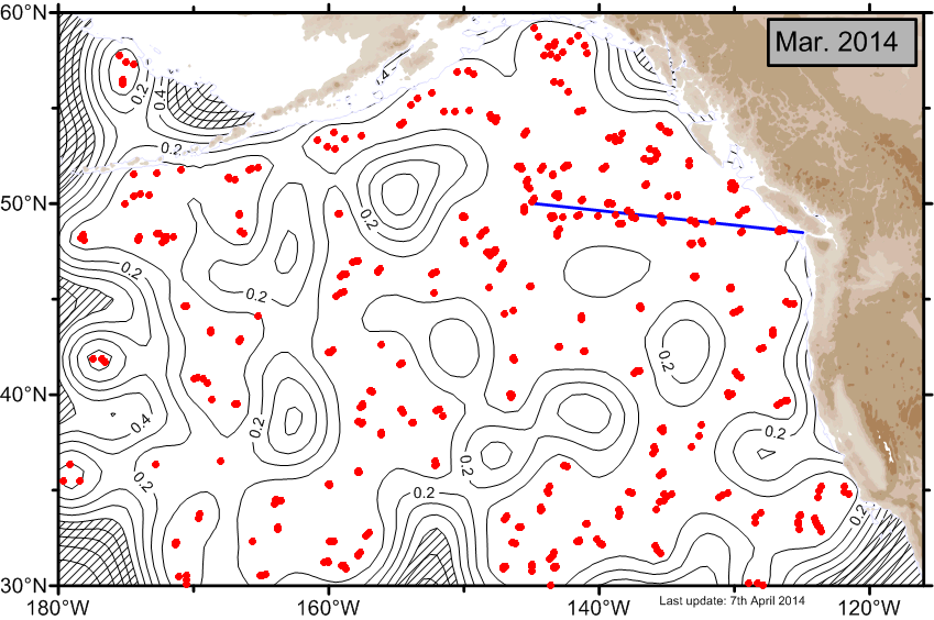
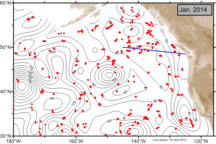
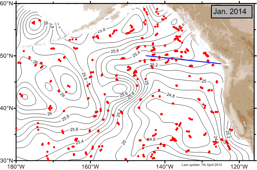
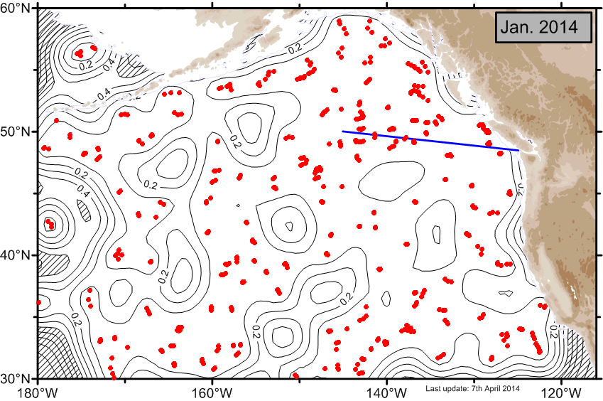
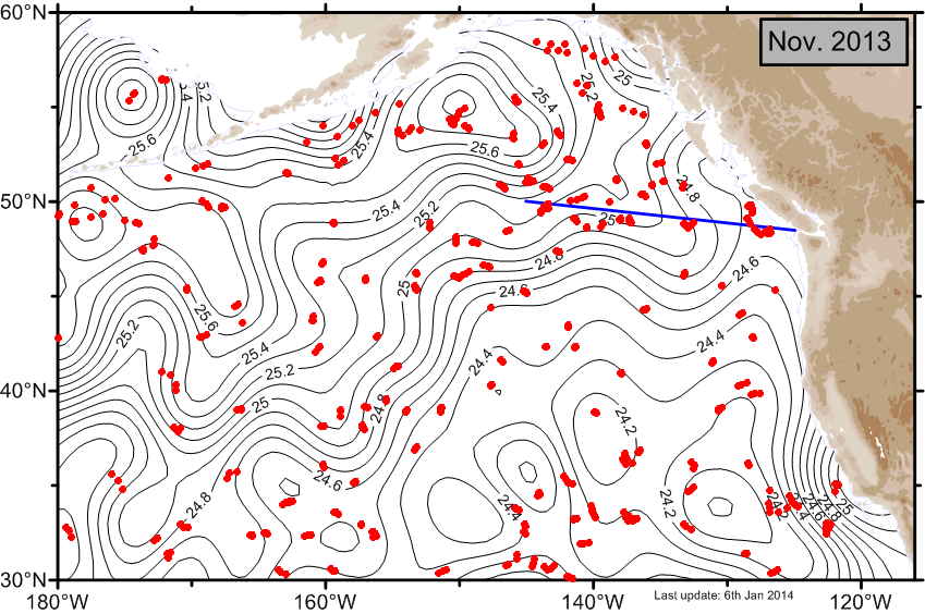
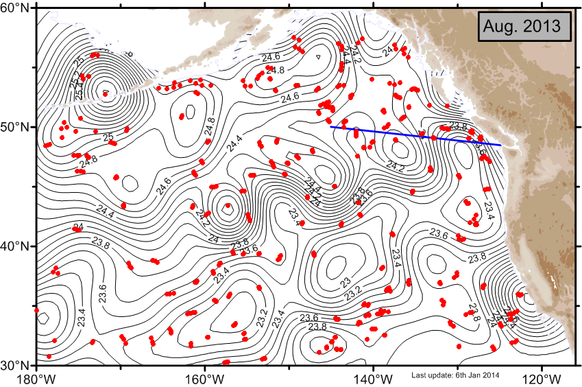
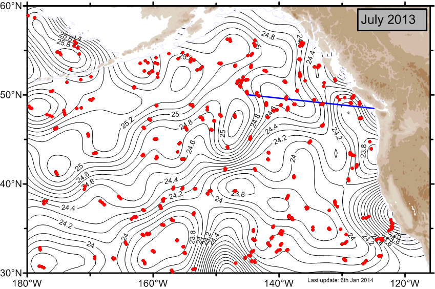
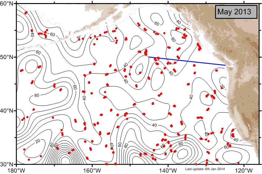
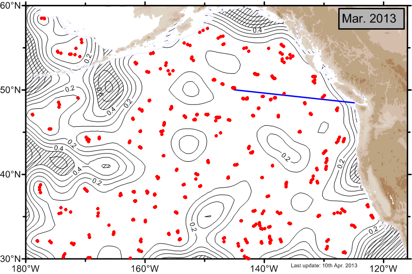
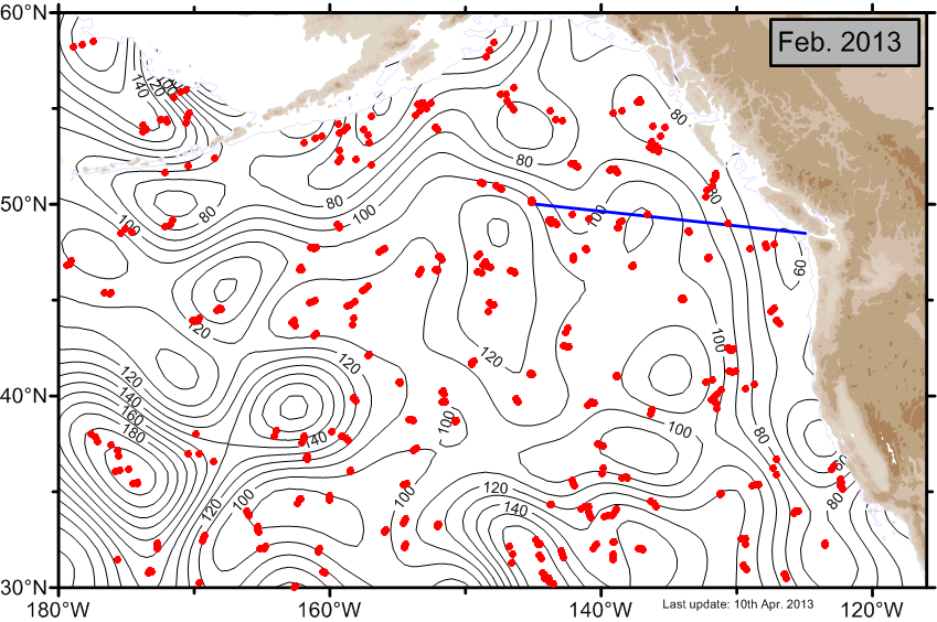
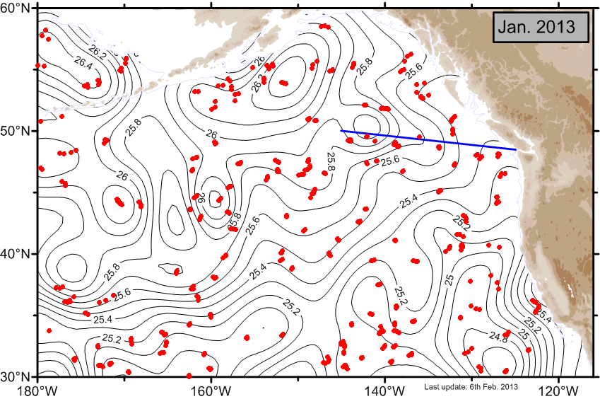
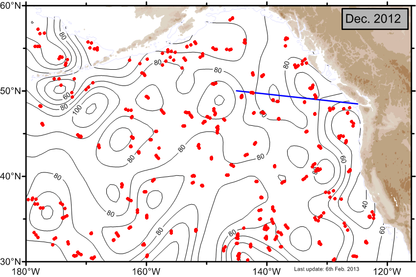
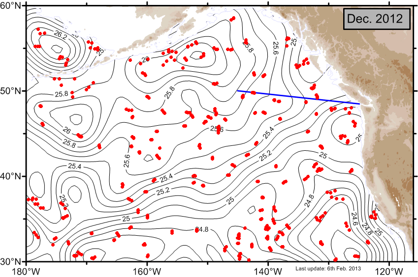
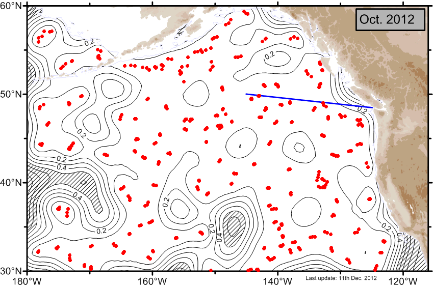
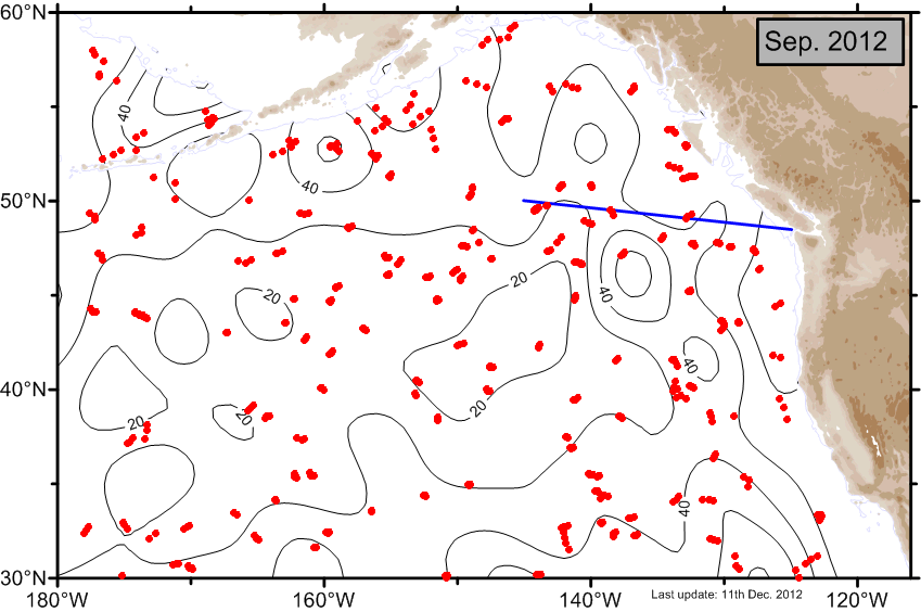
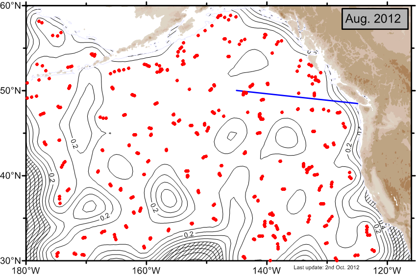
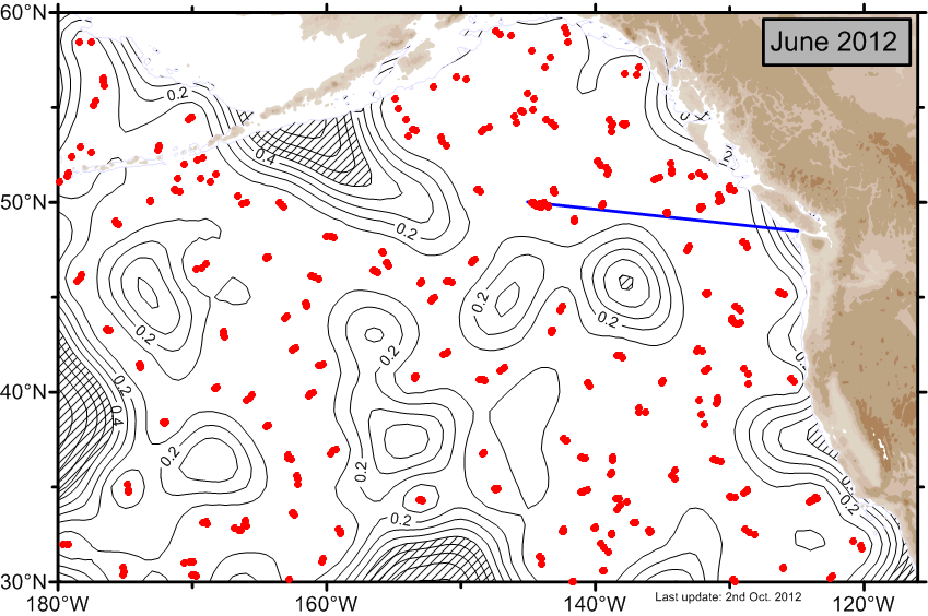
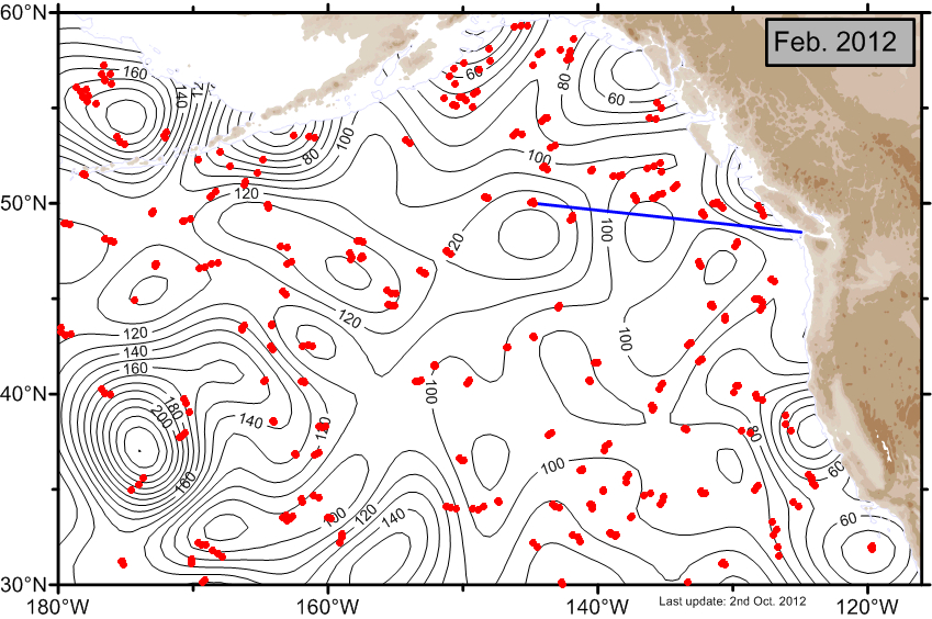
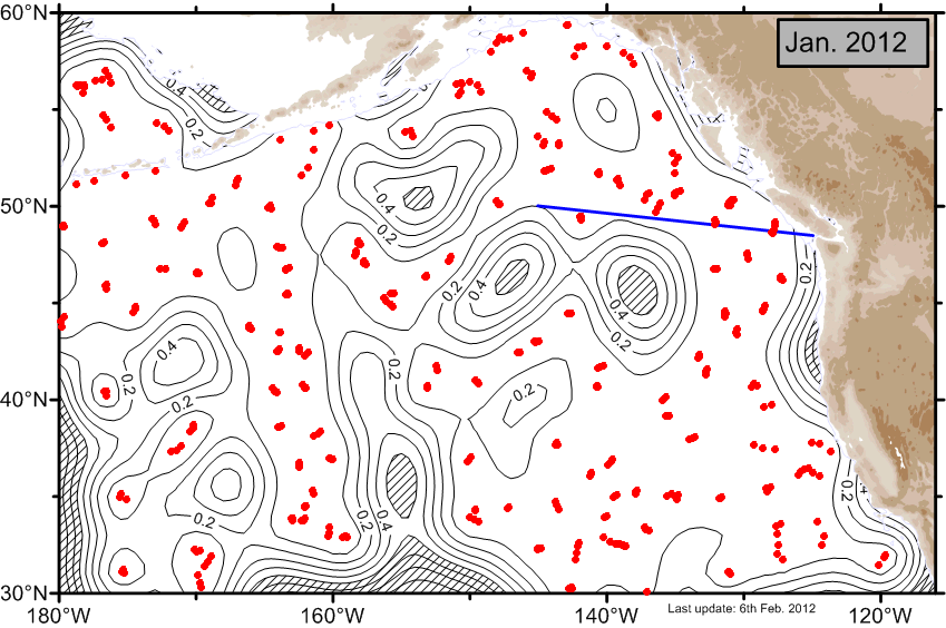
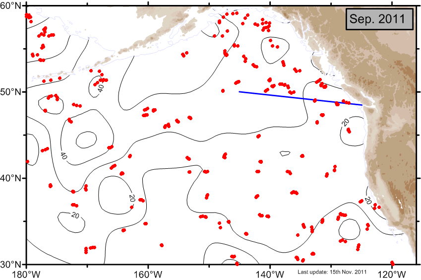
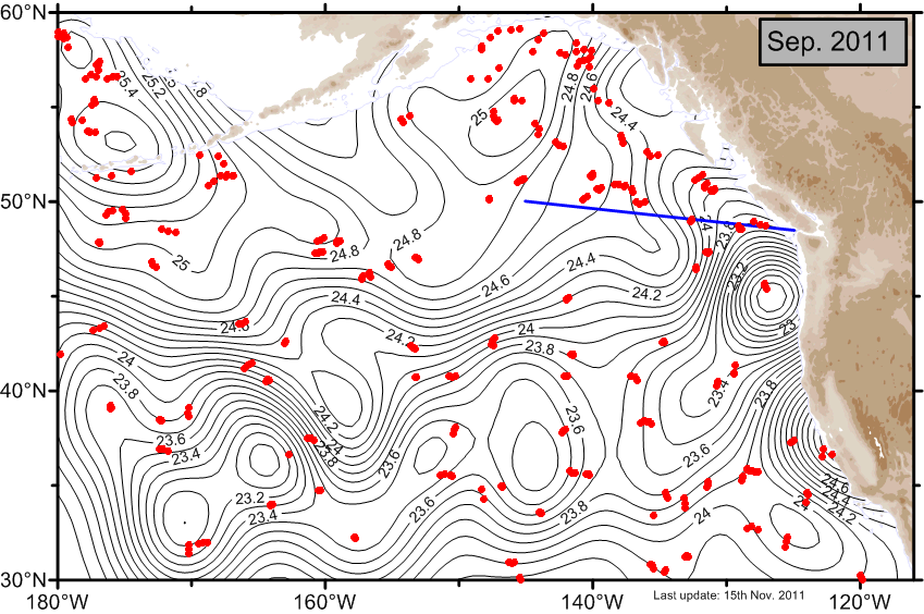
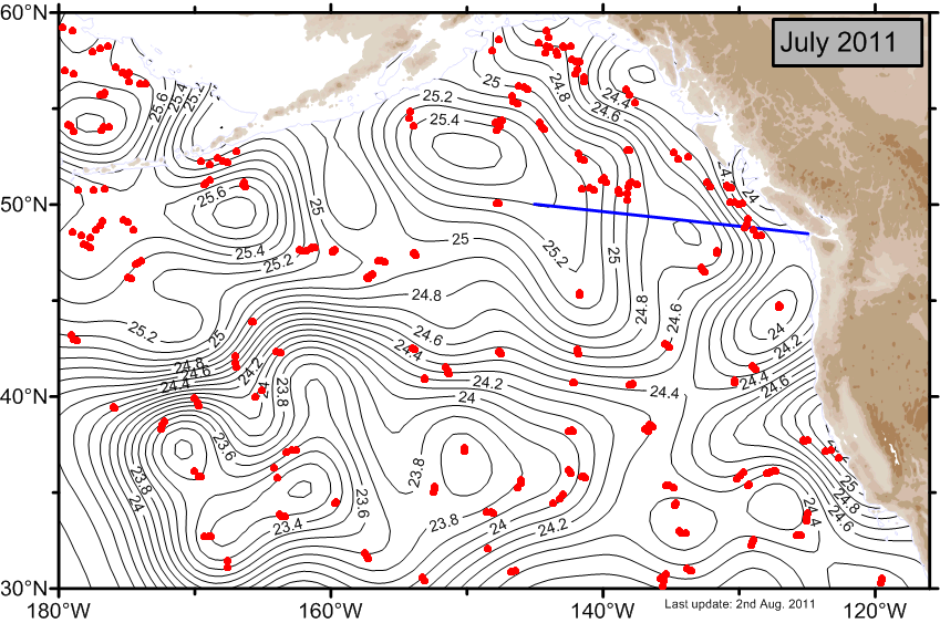
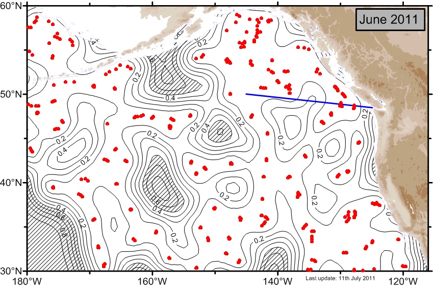
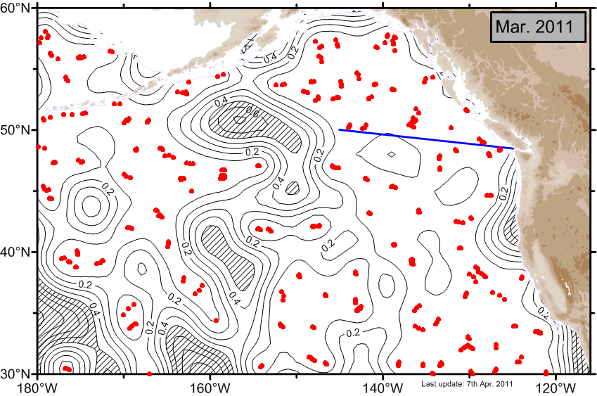
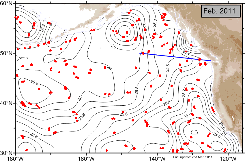
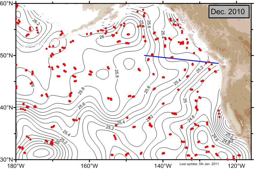
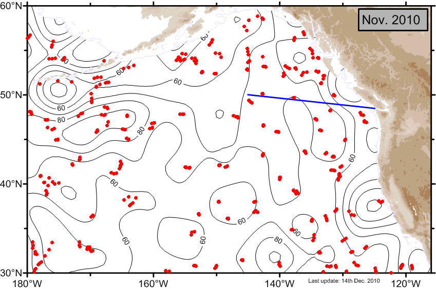
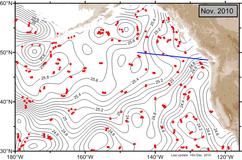
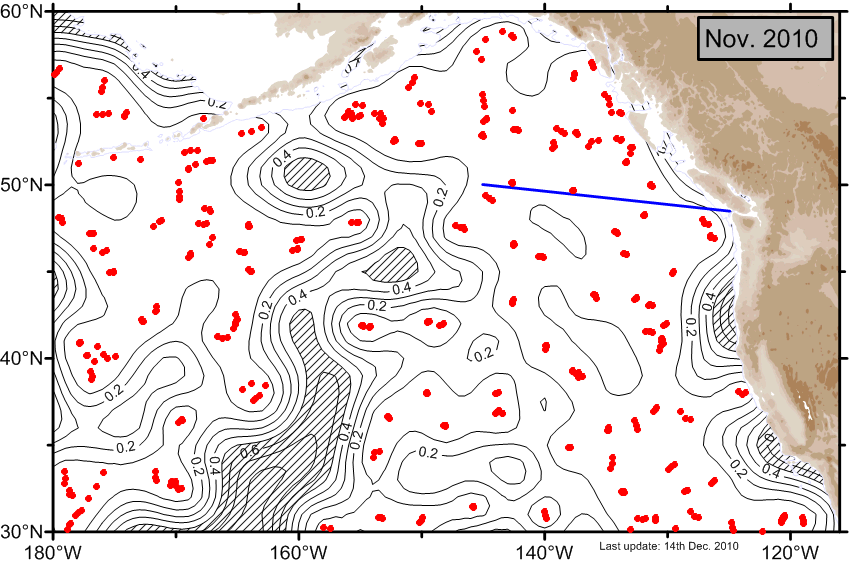
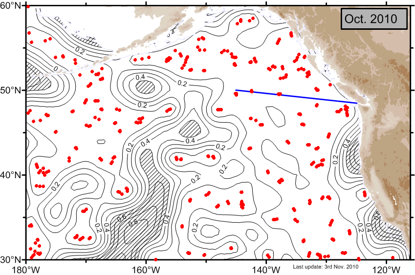
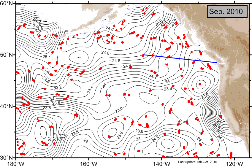
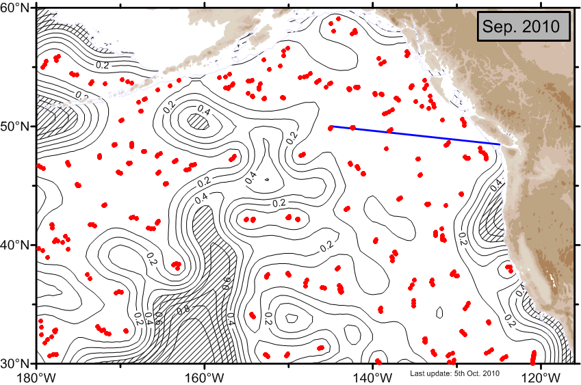
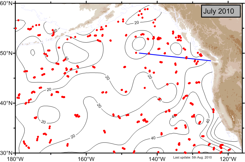
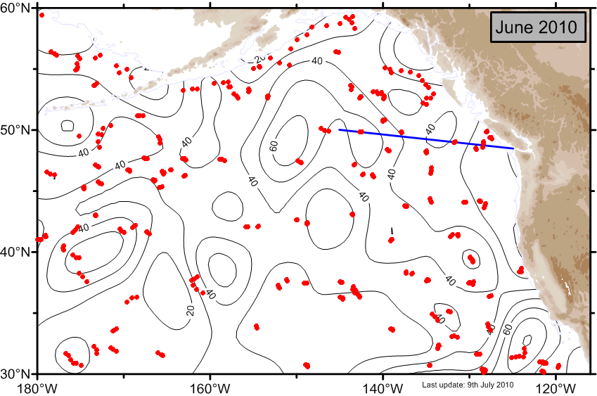
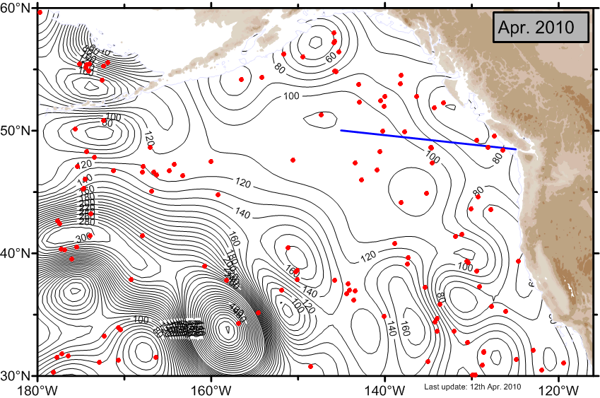
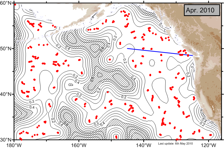
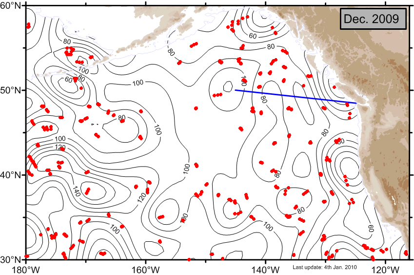
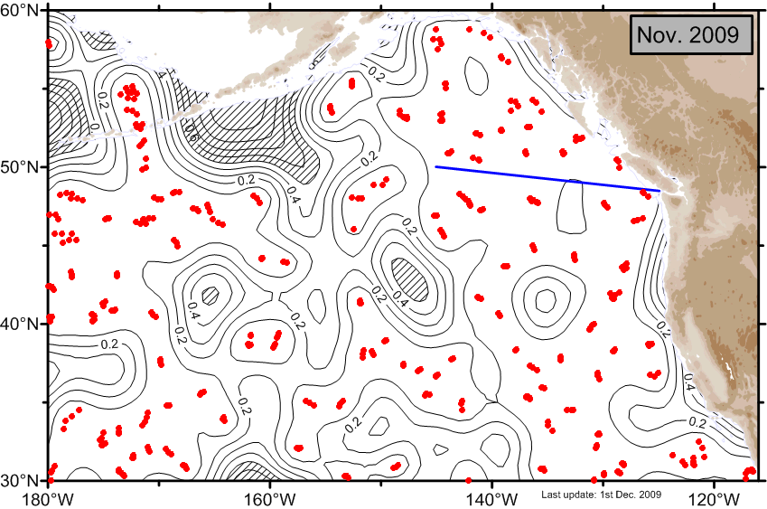
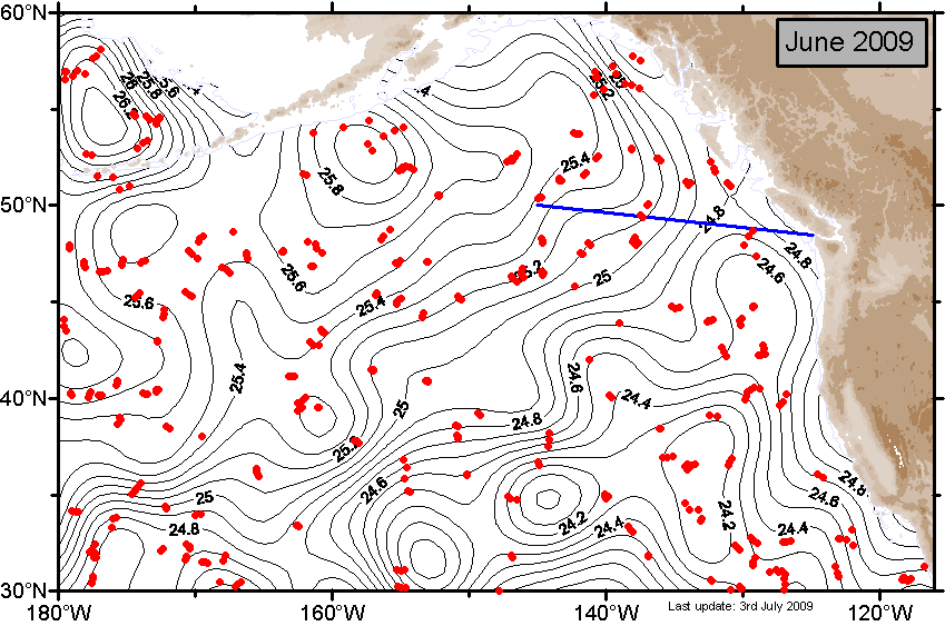
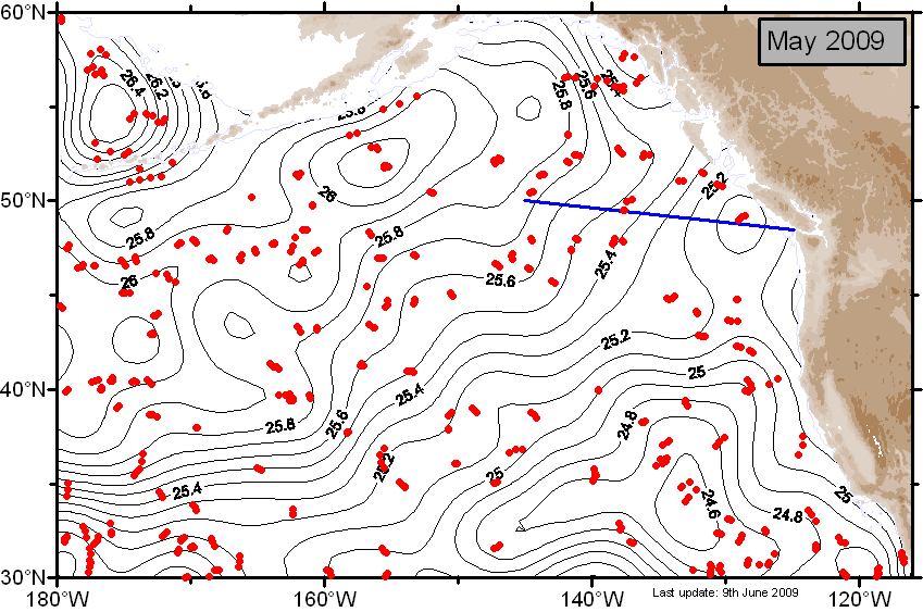
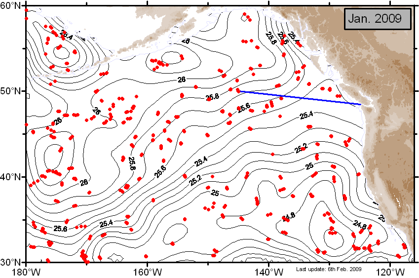
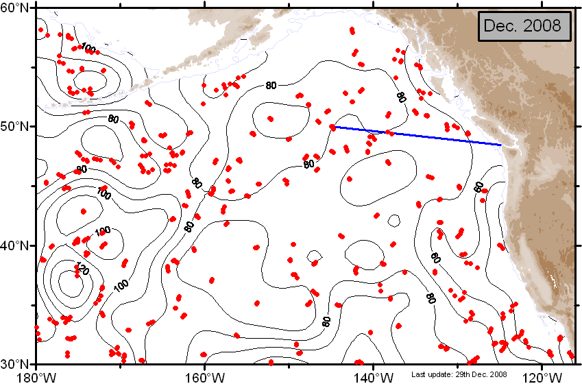
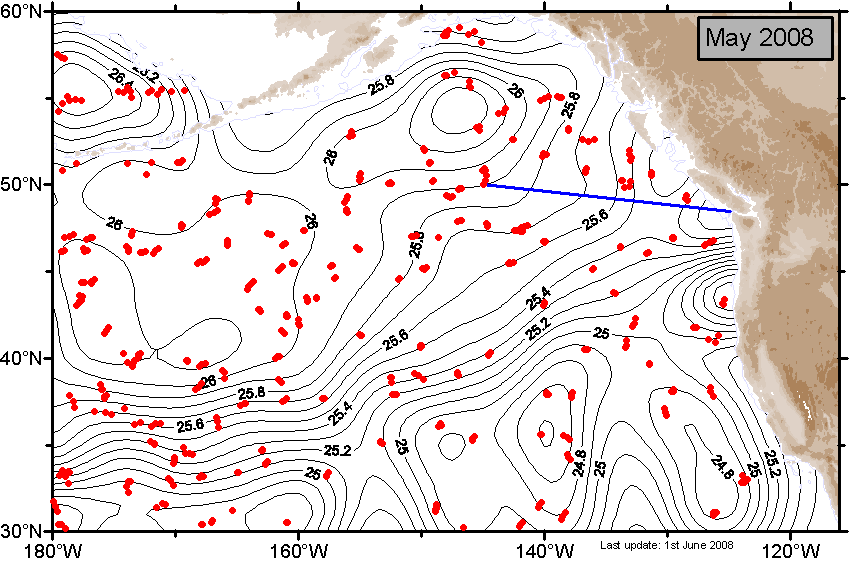
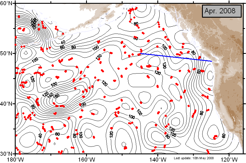
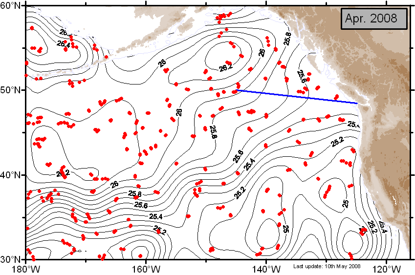
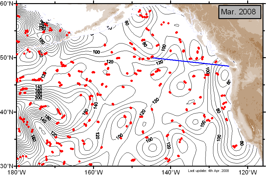
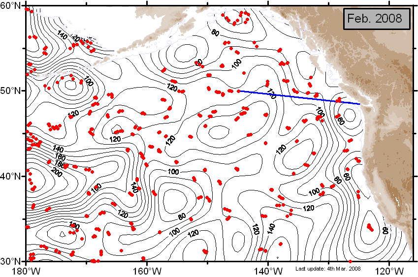
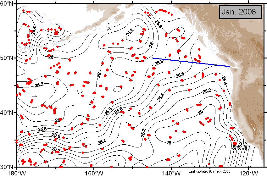
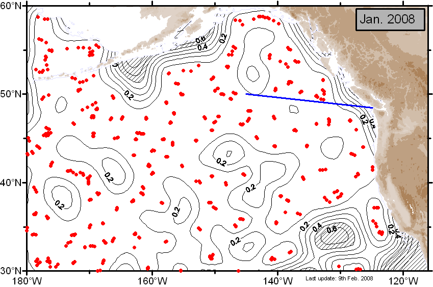
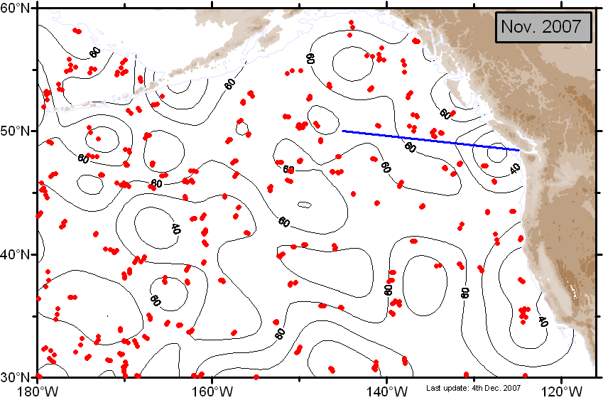
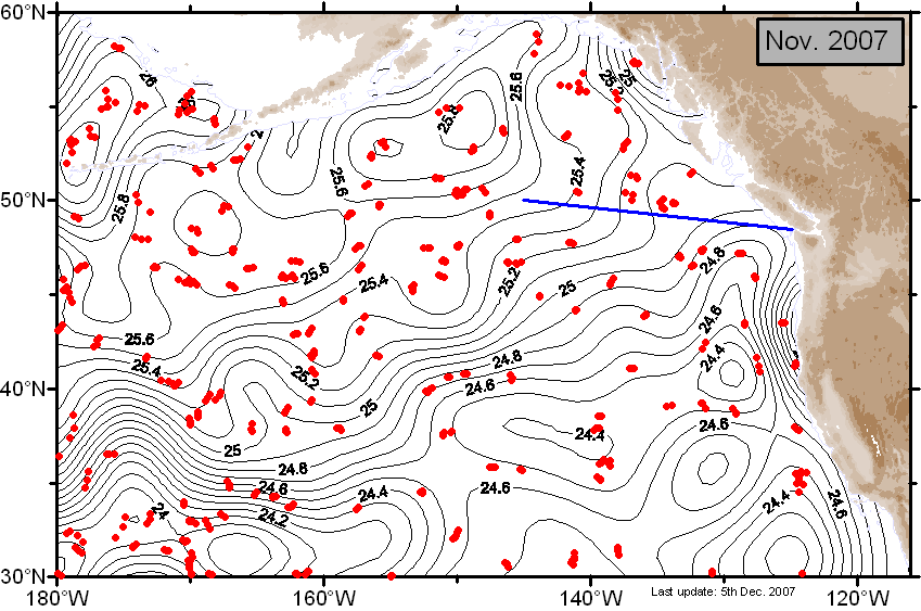
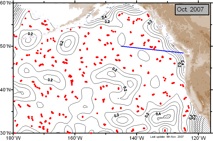
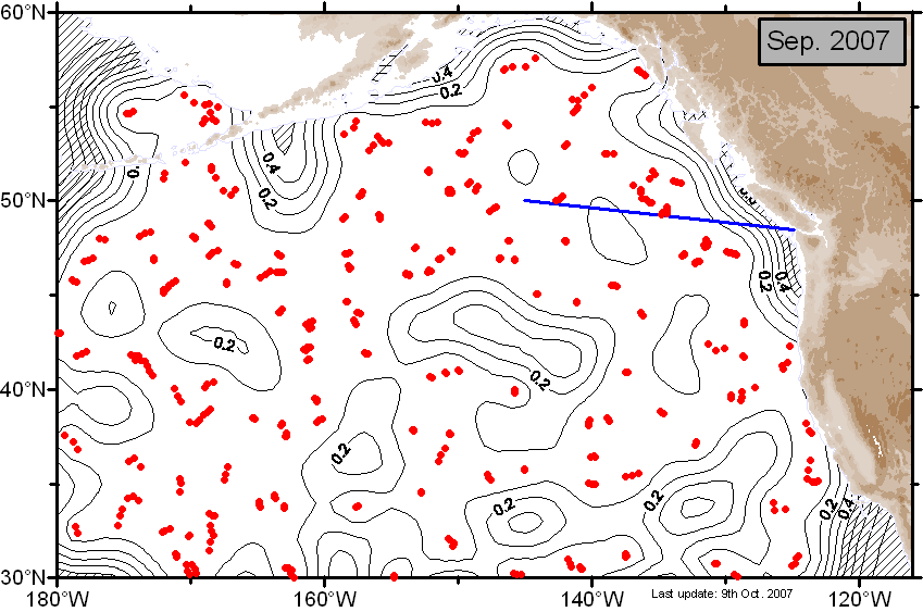
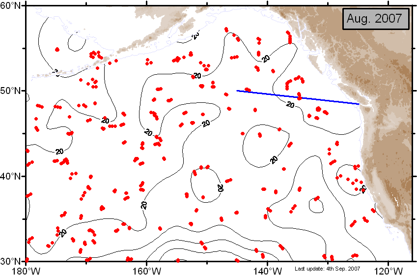
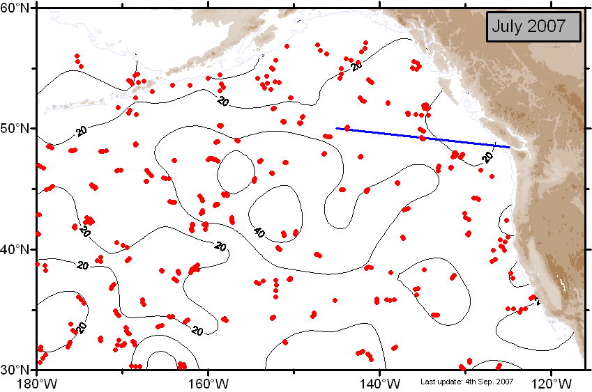
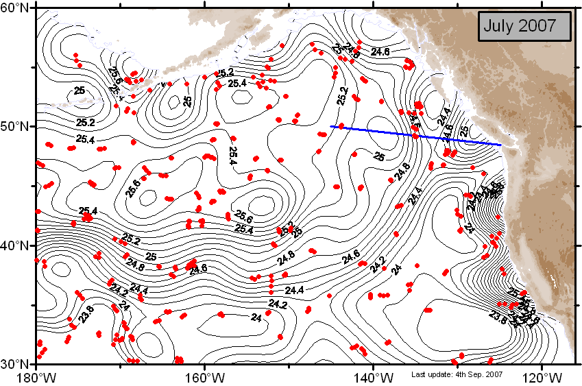
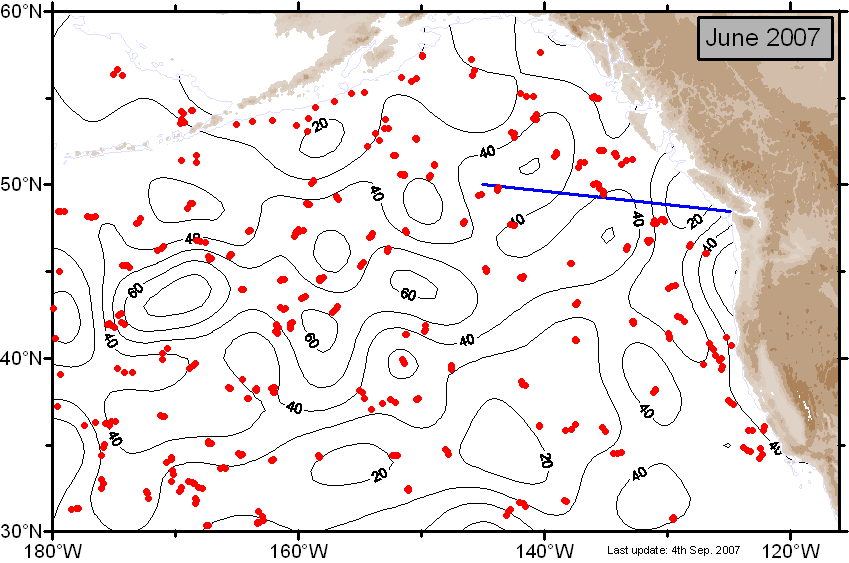
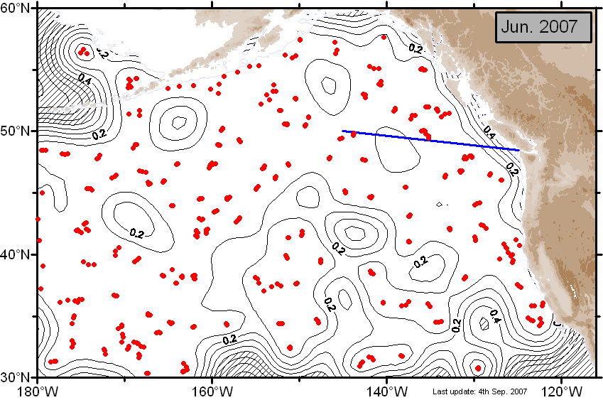
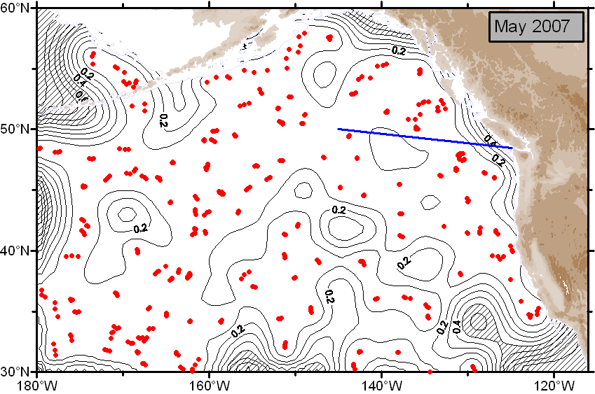
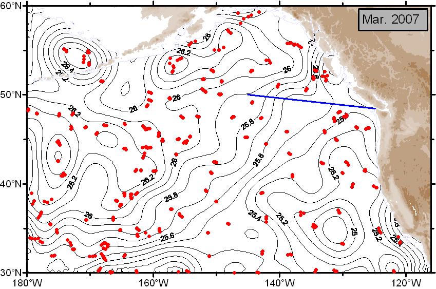
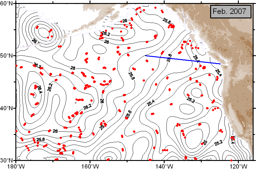
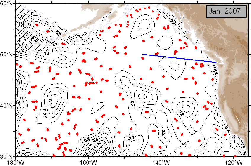
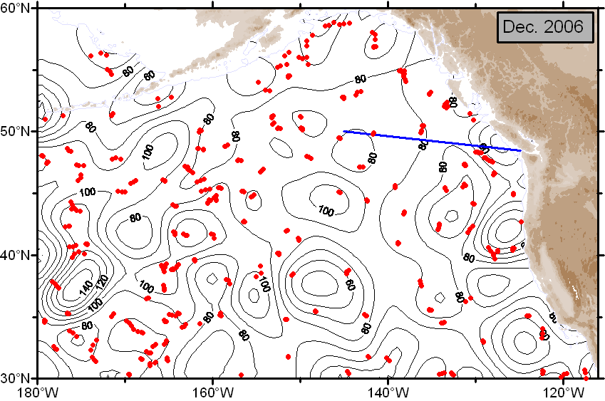
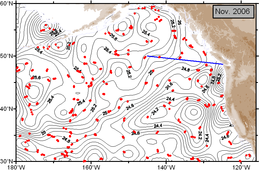
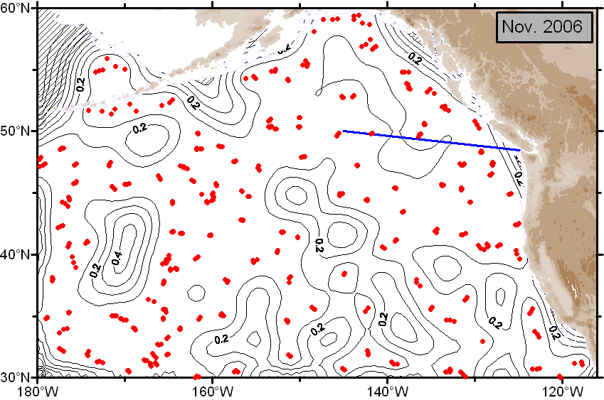
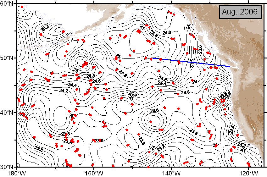
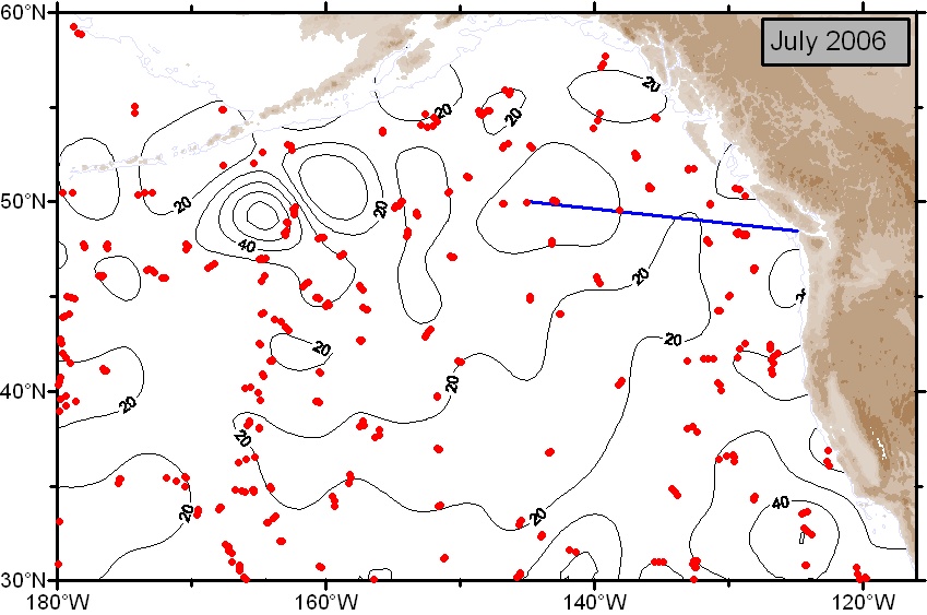
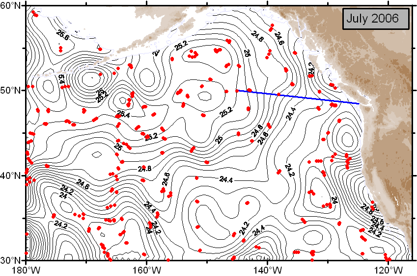
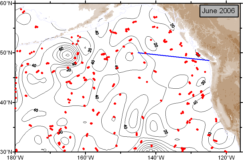
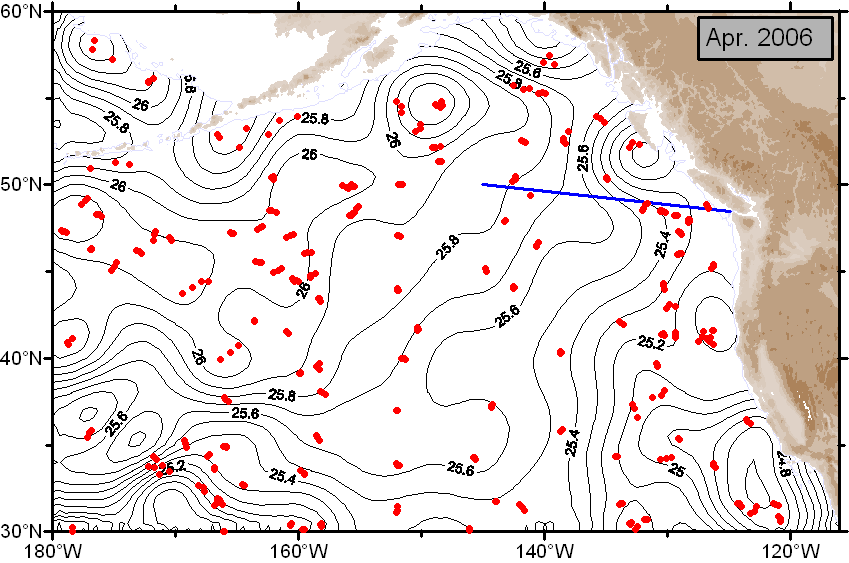
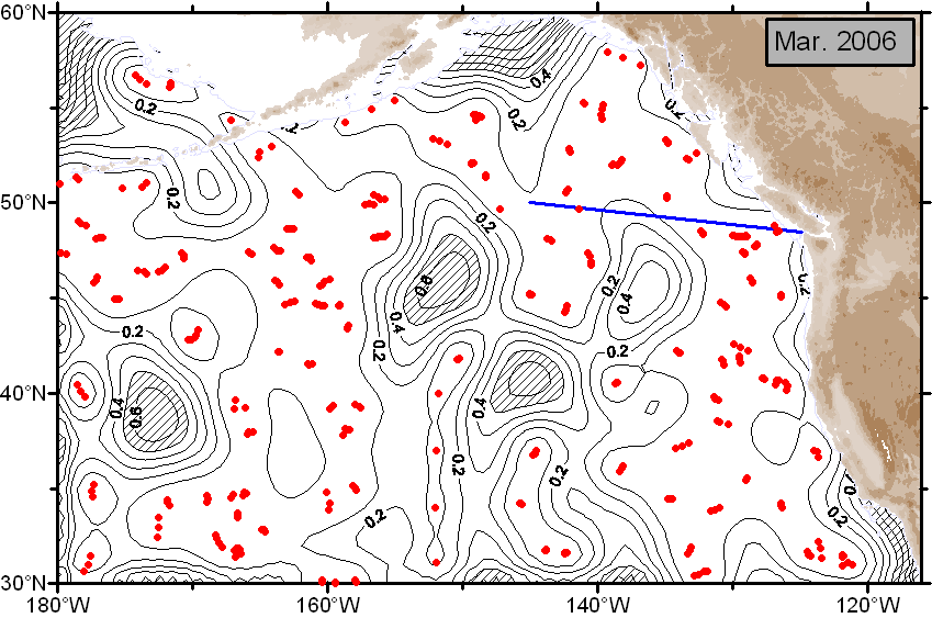
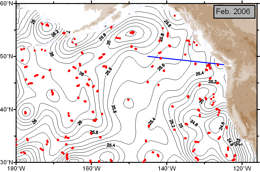
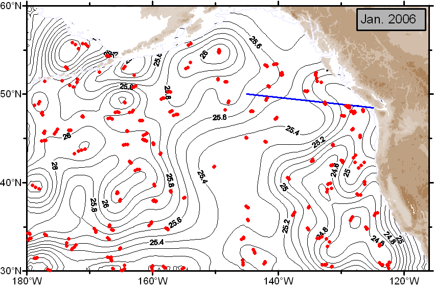
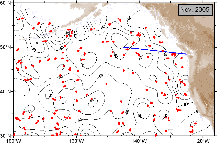
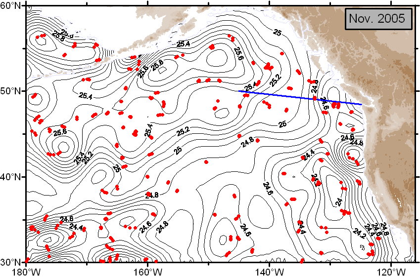
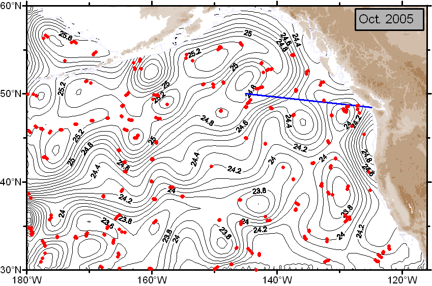
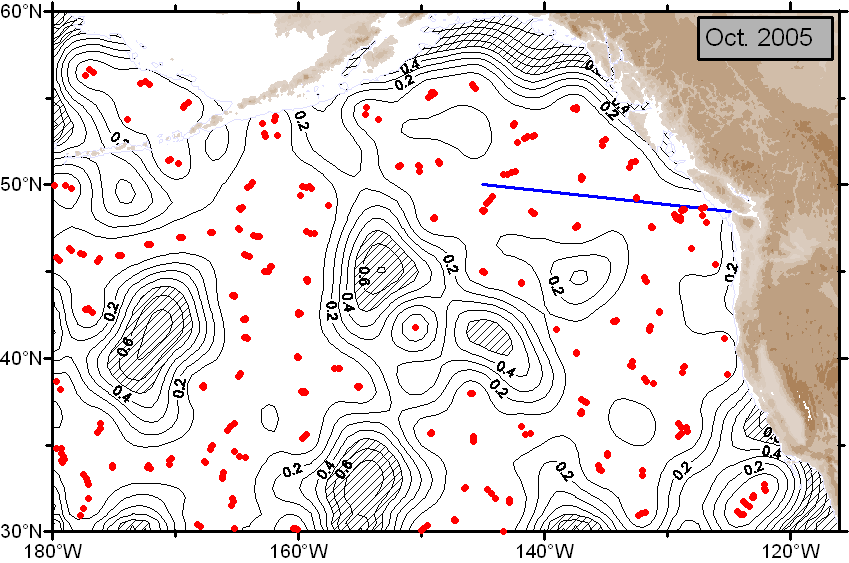
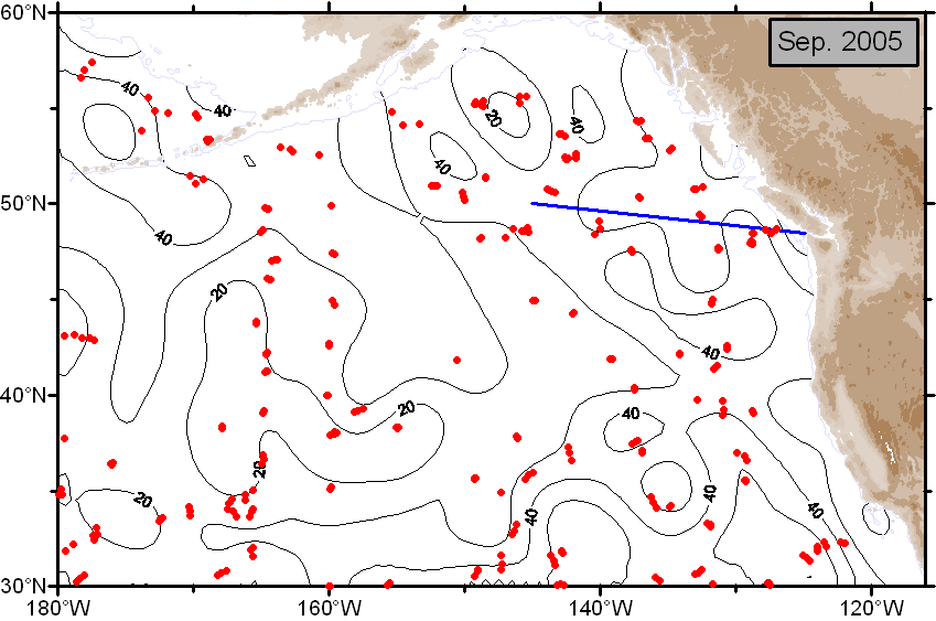
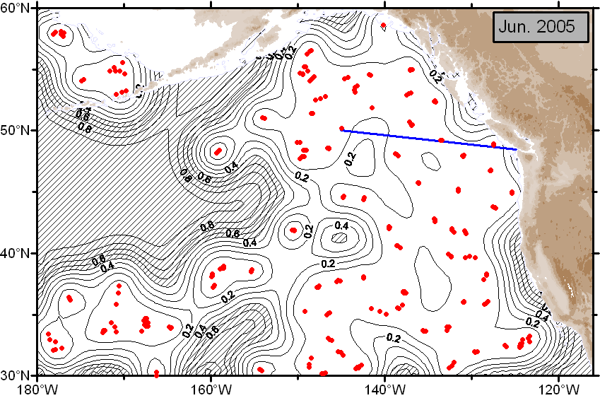
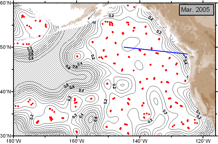
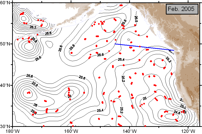
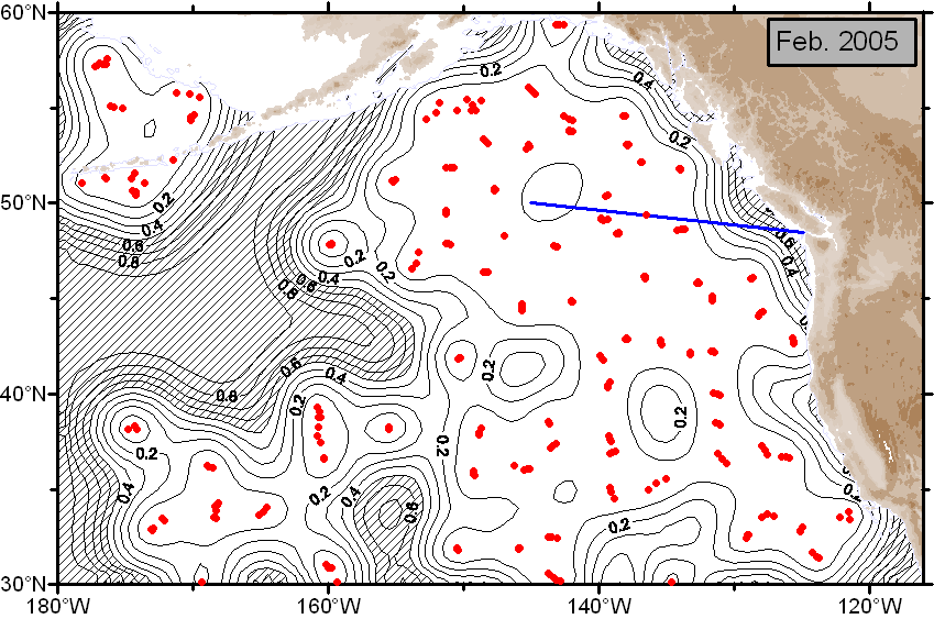
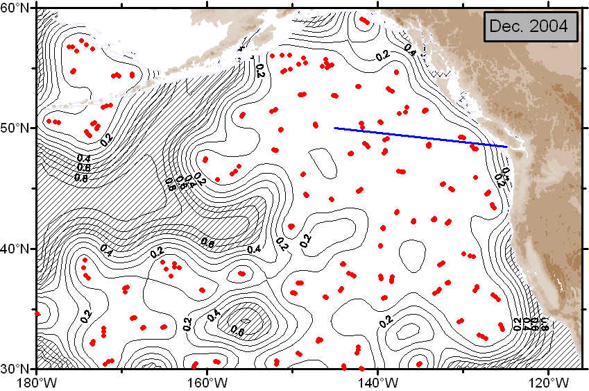
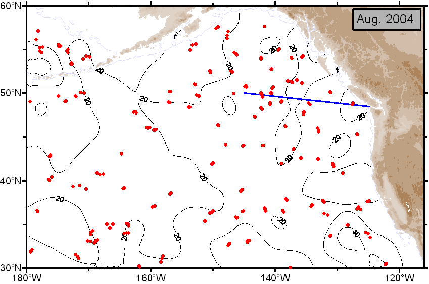
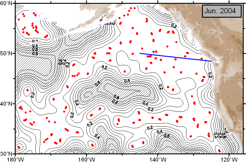
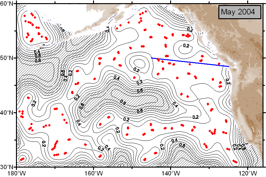
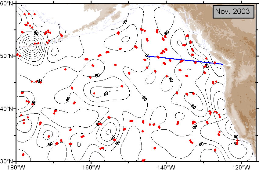
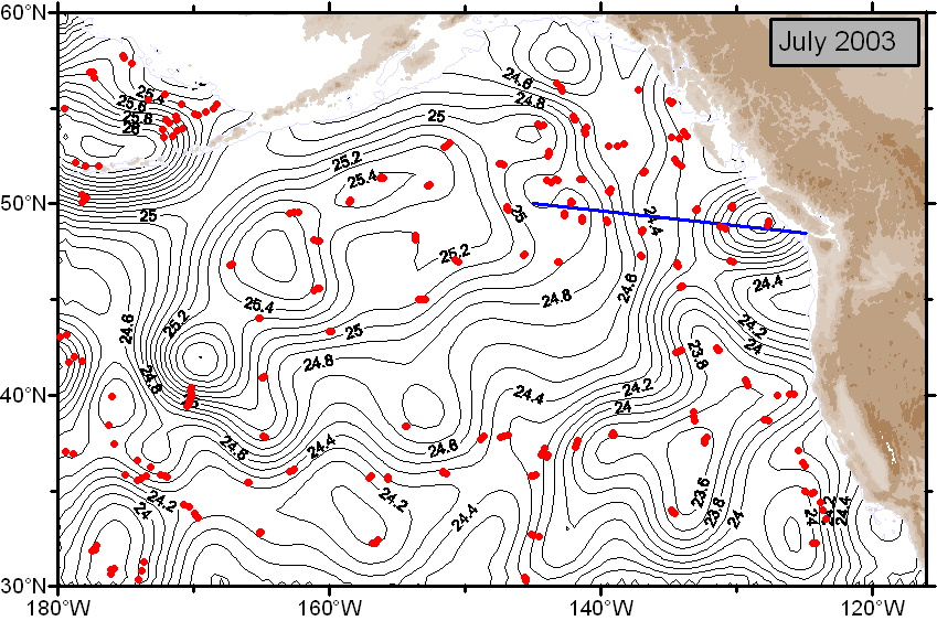
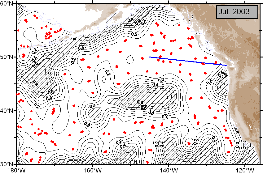
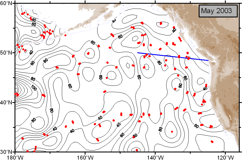
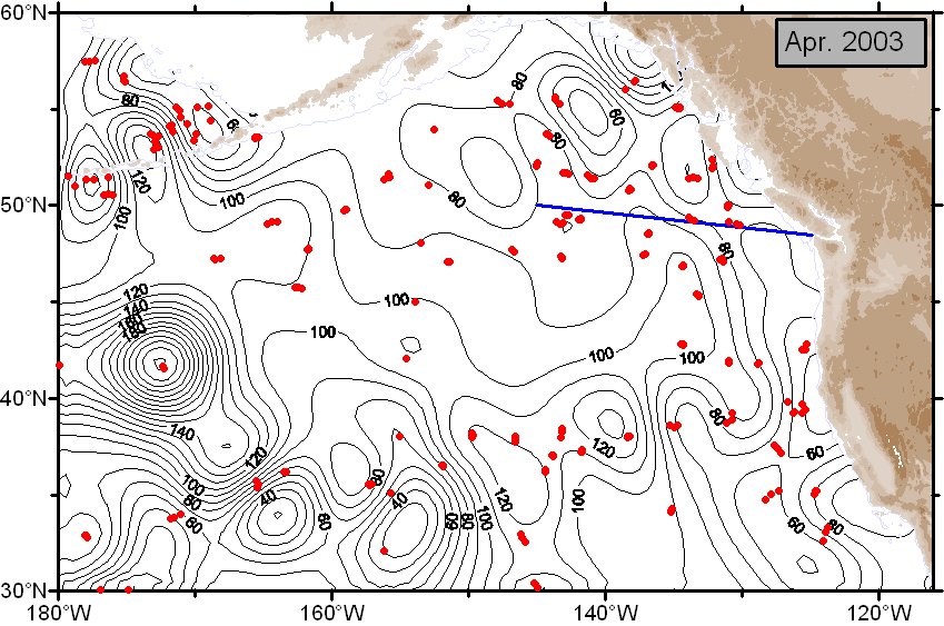
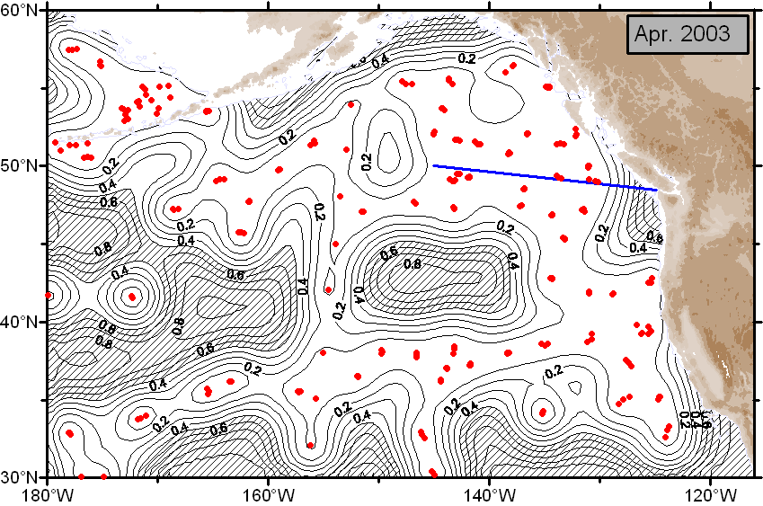
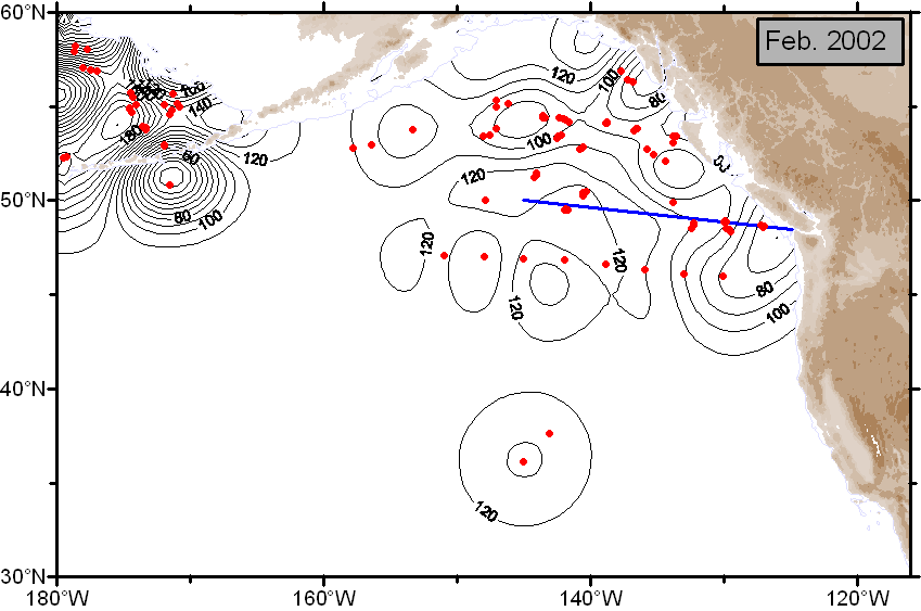
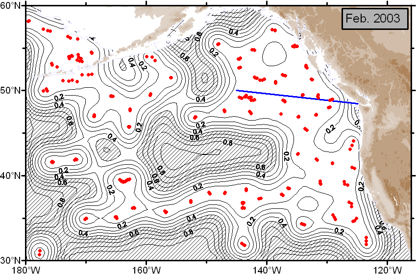
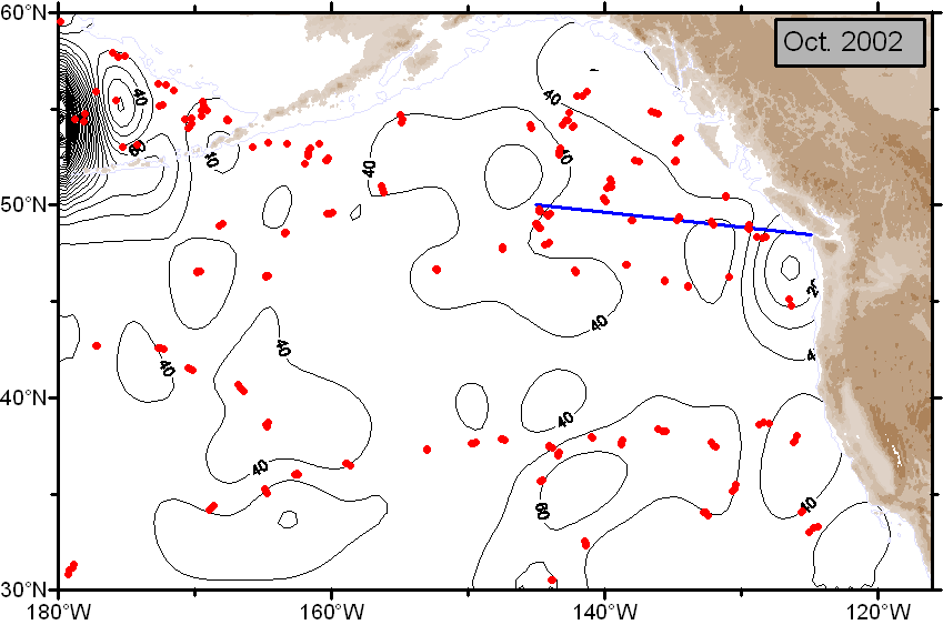
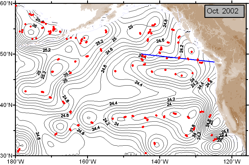
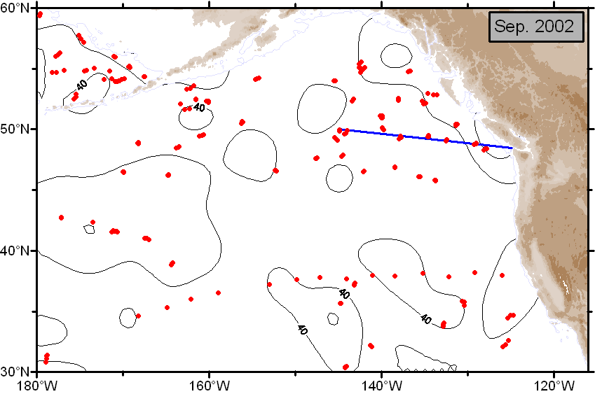
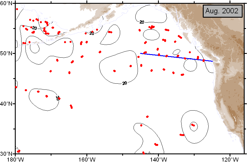
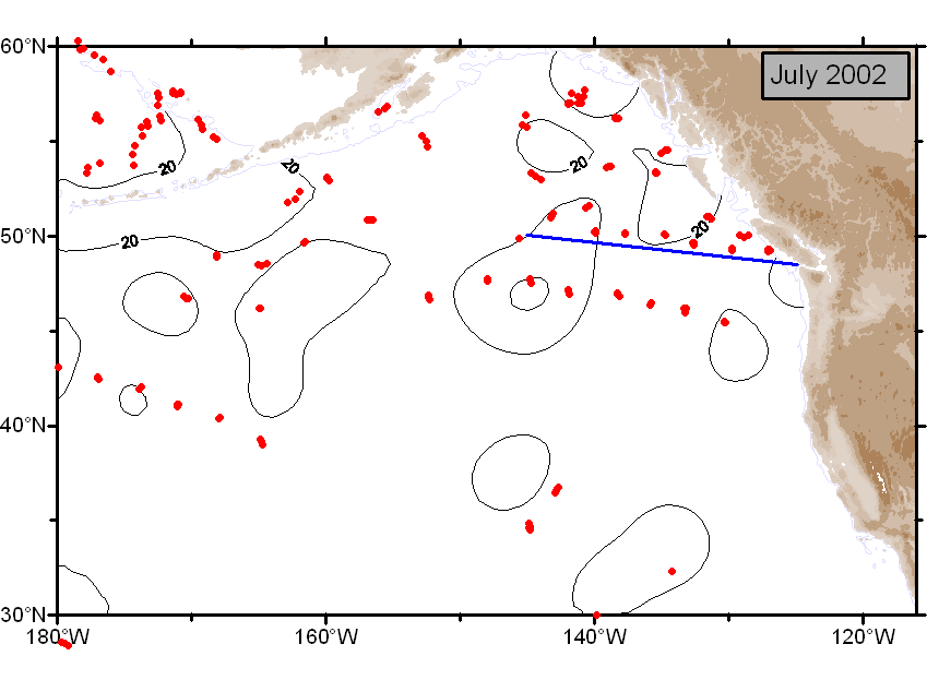
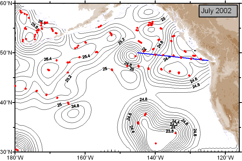
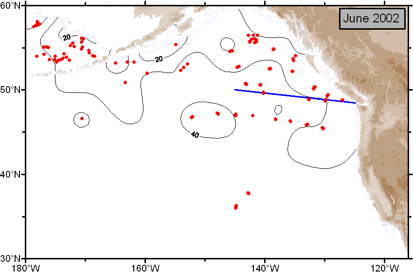
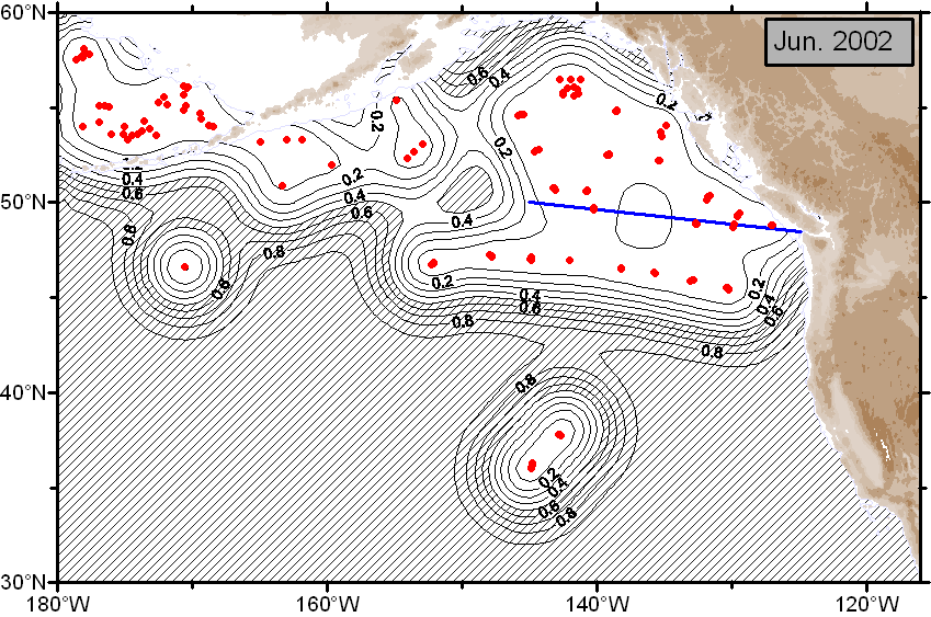
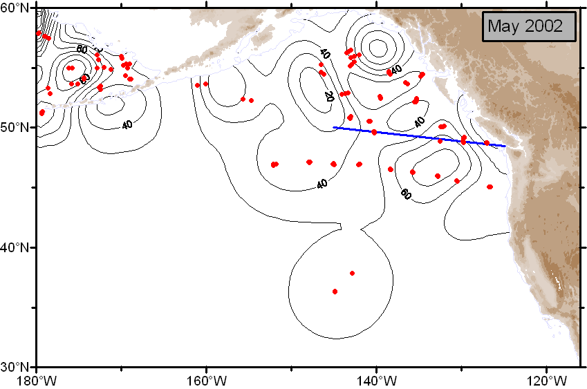
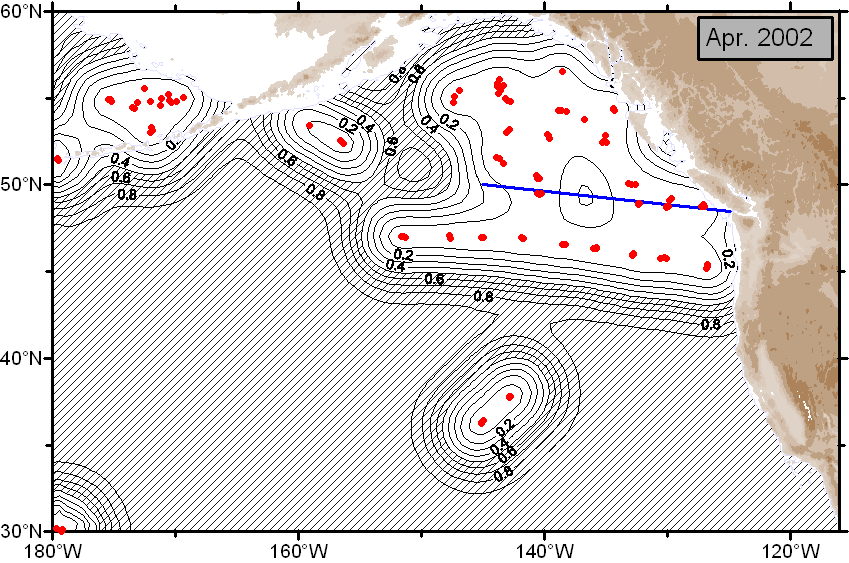
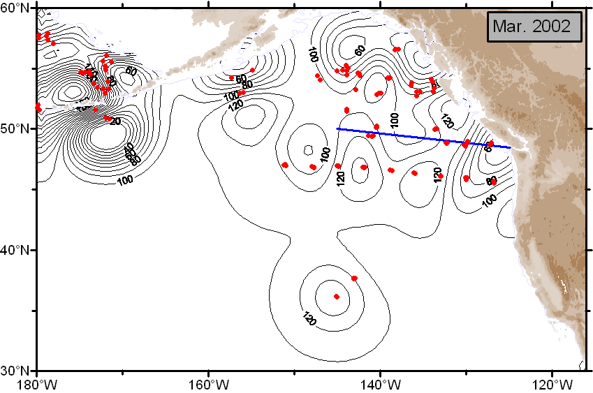
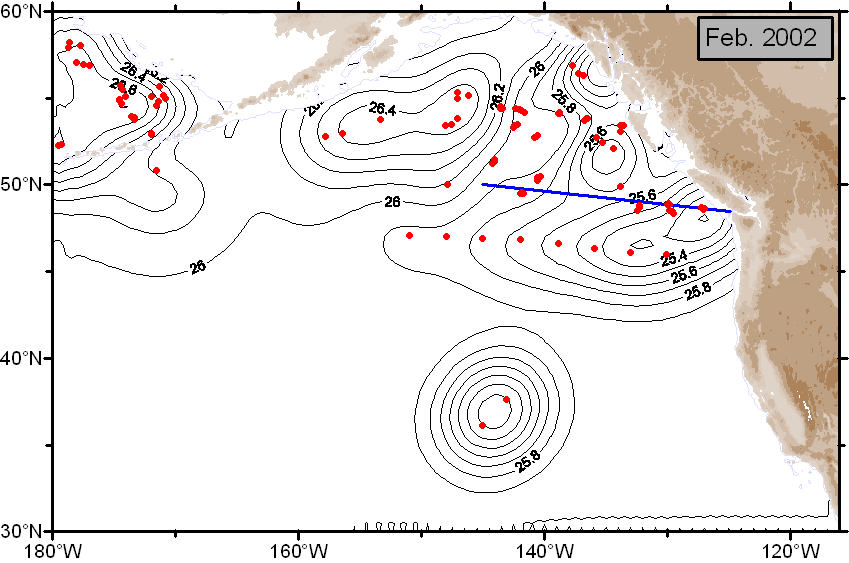
The following plots are generated using data from the Argo floats within the Gulf of Alaska. The plots show the mixed layer depth (button MLD) computed using Kara's method, and sigma-t is the density at the base of the mixed layer. Error is the expected error in standard deviations.
Monthly averages (over available years)
Graphics |
|||||||||||
 Jan Jan
|
 Feb Feb
|
 Mar Mar
|
 Apr Apr
|
 May May
|
 June June
|
 July July
|
 Aug Aug
|
 Sept Sept
|
 Oct Oct
|
 Nov Nov
|
 Dec Dec
|
CSV Files |
|||||||||||
| Jan | Feb | Mar | Apr | May | June | July | Aug | Sept | Oct | Nov | Dec |
2016 |
|||||
| October |
 MLD MLD
|
.csv |
 σt σt
|
 Error Error
|
.csv |
| September |
 MLD MLD
|
.csv |
 σt σt
|
 Error Error
|
.csv |
| August |
 MLD MLD
|
.csv |
 σt σt
|
 Error Error
|
.csv |
| July |
 MLD MLD
|
.csv |
 σt σt
|
 Error Error
|
.csv |
| June |
 MLD MLD
|
.csv |
 σt σt
|
 Error Error
|
.csv |
| May |
 MLD MLD
|
.csv |
 σt σt
|
 Error Error
|
.csv |
| April |
 MLD MLD
|
.csv |
 σt σt
|
 Error Error
|
.csv |
| March |
 MLD MLD
|
.csv |
 σt σt
|
 Error Error
|
.csv |
| February |
 MLD MLD
|
.csv |
 σt σt
|
 Error Error
|
.csv |
| January |
 MLD MLD
|
.csv |
 σt σt
|
 Error Error
|
.csv |
2015 |
|||||
| December |
 MLD MLD
|
.csv |
 σt σt
|
 Error Error
|
.csv |
| November |
 MLD MLD
|
.csv |
 σt σt
|
 Error Error
|
.csv |
| October |
 MLD MLD
|
.csv |
 σt σt
|
 Error Error
|
.csv |
| September |
 MLD MLD
|
.csv |
 σt σt
|
 Error Error
|
.csv |
| August |
 MLD MLD
|
.csv |
 σt σt
|
 Error Error
|
.csv |
| July |
 MLD MLD
|
.csv |
 σt σt
|
 Error Error
|
.csv |
| June |
 MLD MLD
|
.csv |
 σt σt
|
 Error Error
|
.csv |
| May |
 MLD MLD
|
.csv |
 σt σt
|
 Error Error
|
.csv |
| April |
 MLD MLD
|
.csv |
 σt σt
|
 Error Error
|
.csv |
| March |
 MLD MLD
|
.csv |
 σt σt
|
 Error Error
|
.csv |
| February |
 MLD MLD
|
.csv |
 σt σt
|
 Error Error
|
.csv |
| January |
 MLD MLD
|
.csv |
 σt σt
|
 Error Error
|
.csv |
2014 |
|||||
| December |
 MLD MLD
|
.csv |
 σt σt
|
 Error Error
|
.csv |
| November |
 MLD MLD
|
.csv |
 σt σt
|
 Error Error
|
.csv |
| October |
 MLD MLD
|
.csv |
 σt σt
|
 Error Error
|
.csv |
| September |
 MLD MLD
|
.csv |
 σt σt
|
 Error Error
|
.csv |
| August |
 MLD MLD
|
.csv |
 σt σt
|
 Error Error
|
.csv |
| July |
 MLD MLD
|
.csv |
 σt σt
|
 Error Error
|
.csv |
| June |
 MLD MLD
|
.csv |
 σt σt
|
 Error Error
|
.csv |
| May |
 MLD MLD
|
.csv |
 σt σt
|
 Error Error
|
.csv |
| April |
 MLD MLD
|
.csv |
 σt σt
|
 Error Error
|
.csv |
| March |
 MLD MLD
|
.csv |
 σt σt
|
 Error Error
|
.csv |
| February |
 MLD MLD
|
.csv |
 σt σt
|
 Error Error
|
.csv |
| January |
 MLD MLD
|
.csv |
 σt σt
|
 Error Error
|
.csv |
2013 |
|||||
| December |
 MLD MLD
|
.csv |
 σt σt
|
 Error Error
|
.csv |
| November |
 MLD MLD
|
.csv |
 σt σt
|
 Error Error
|
.csv |
| October |
 MLD MLD
|
.csv |
 σt σt
|
 Error Error
|
.csv |
| September |
 MLD MLD
|
.csv |
 σt σt
|
 Error Error
|
.csv |
| August |
 MLD MLD
|
.csv |
 σt σt
|
 Error Error
|
.csv |
| July |
 MLD MLD
|
.csv |
 σt σt
|
 Error Error
|
.csv |
| June |
 MLD MLD
|
.csv |
 σt σt
|
 Error Error
|
.csv |
| May |
 MLD MLD
|
.csv |
 σt σt
|
 Error Error
|
.csv |
| April |
 MLD MLD
|
.csv |
 σt σt
|
 Error Error
|
.csv |
| March |
 MLD MLD
|
.csv |
 σt σt
|
 Error Error
|
.csv |
| Febuary |
 MLD MLD
|
.csv |
 σt σt
|
 Error Error
|
.csv |
| January |
 MLD MLD
|
.csv |
 σt σt
|
 Error Error
|
.csv |
2012 |
|||||
| December |
 MLD MLD
|
.csv |
 σt σt
|
 Error Error
|
.csv |
| November |
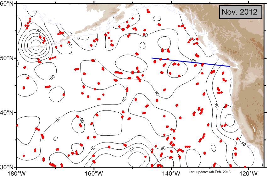 MLD MLD
|
.csv |
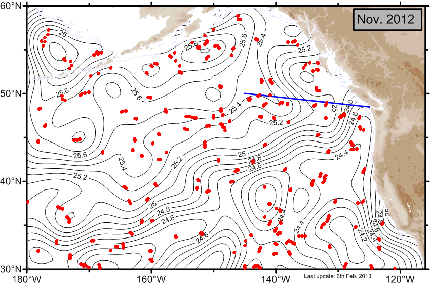 σt σt
|
 Error Error
|
.csv |
| October |
 MLD MLD
|
.csv |
 σt σt
|
 Error Error
|
.csv |
| September |
 MLD MLD
|
.csv |
 σt σt
|
 Error Error
|
.csv |
| August |
 MLD MLD
|
.csv |
 σt σt
|
 Error Error
|
.csv |
| July |
 MLD MLD
|
.csv |
 σt σt
|
 Error Error
|
.csv |
| June |
 MLD MLD
|
.csv |
 σt σt
|
 Error Error
|
.csv |
| May |
 MLD MLD
|
.csv |
 σt σt
|
 Error Error
|
.csv |
| April |
 MLD MLD
|
.csv |
 σt σt
|
 Error Error
|
.csv |
| March |
 MLD MLD
|
.csv |
 σt σt
|
 Error Error
|
.csv |
| February |
 MLD MLD
|
.csv |
 σt σt
|
 Error Error
|
.csv |
| January |
 MLD MLD
|
.csv |
 σt σt
|
 Error Error
|
.csv |
2011 |
|||||
| December |
 MLD MLD
|
.csv |
 σt σt
|
 Error Error
|
.csv |
| November |
 MLD MLD
|
.csv |
 σt σt
|
 Error Error
|
.csv |
| October |
 MLD MLD
|
.csv |
 σt σt
|
 Error Error
|
.csv |
| September |
 MLD MLD
|
.csv |
 σt σt
|
 Error Error
|
.csv |
| August |
 MLD MLD
|
.csv |
 σt σt
|
 Error Error
|
.csv |
| July |
 MLD MLD
|
.csv |
 σt σt
|
 Error Error
|
.csv |
| June |
 MLD MLD
|
.csv |
 σt σt
|
 Error Error
|
.csv |
| May |
 MLD MLD
|
.csv |
 σt σt
|
 Error Error
|
.csv |
| April |
 MLD MLD
|
.csv |
 σt σt
|
 Error Error
|
.csv |
| March |
 MLD MLD
|
.csv |
 σt σt
|
 Error Error
|
.csv |
| February |
 MLD MLD
|
.csv |
 σt σt
|
 Error Error
|
.csv |
| January |
 MLD MLD
|
.csv |
 σt σt
|
 Error Error
|
.csv |
2010 |
|||||
| December |
 MLD MLD
|
.csv |
 σt σt
|
 Error Error
|
.csv |
| November |
 MLD MLD
|
.csv |
 σt σt
|
 Error Error
|
.csv |
| October |
 MLD MLD
|
.csv |
 σt σt
|
 Error Error
|
.csv |
| September |
 MLD MLD
|
.csv |
 σt σt
|
 Error Error
|
.csv |
| August |
 MLD MLD
|
.csv |
 σt σt
|
 Error Error
|
.csv |
| July |
 MLD MLD
|
.csv |
 σt σt
|
 Error Error
|
.csv |
| June |
 MLD MLD
|
.csv |
 σt σt
|
 Error Error
|
.csv |
| May |
 MLD MLD
|
.csv |
 σt σt
|
 Error Error
|
.csv |
| April |
 MLD MLD
|
.csv |
 σt σt
|
 Error Error
|
.csv |
| March |
 MLD MLD
|
.csv |
 σt σt
|
 Error Error
|
.csv |
| February |
 MLD MLD
|
.csv |
 σt σt
|
 Error Error
|
.csv |
| January |
 MLD MLD
|
.csv |
 σt σt
|
 Error Error
|
.csv |
2009 |
|||||
| December |
 MLD MLD
|
.csv |
 σt σt
|
 Error Error
|
.csv |
| November |
 MLD MLD
|
.csv |
 σt σt
|
 Error Error
|
.csv |
| October |
 MLD MLD
|
.csv |
 σt σt
|
 Error Error
|
.csv |
| September |
 MLD MLD
|
.csv |
 σt σt
|
 Error Error
|
.csv |
| August |
 MLD MLD
|
.csv |
 σt σt
|
 Error Error
|
.csv |
| July |
 MLD MLD
|
.csv |
 σt σt
|
 Error Error
|
.csv |
| June |
 MLD MLD
|
.csv |
 σt σt
|
 Error Error
|
.csv |
| May |
 MLD MLD
|
.csv |
 σt σt
|
 Error Error
|
.csv |
| April |
 MLD MLD
|
.csv |
 σt σt
|
 Error Error
|
.csv |
| March |
 MLD MLD
|
.csv |
 σt σt
|
 Error Error
|
.csv |
| February |
 MLD MLD
|
.csv |
 σt σt
|
 Error Error
|
.csv |
| January |
 MLD MLD
|
.csv |
 σt σt
|
 Error Error
|
.csv |
2008 |
|||||
| December |
 MLD MLD
|
.csv |
 σt σt
|
 Error Error
|
.csv |
| November |
 MLD MLD
|
.csv |
 σt σt
|
 Error Error
|
.csv |
| October |
 MLD MLD
|
.csv |
 σt σt
|
 Error Error
|
.csv |
| September |
 MLD MLD
|
.csv |
 σt σt
|
 Error Error
|
.csv |
| August |
 MLD MLD
|
.csv |
 σt σt
|
 Error Error
|
.csv |
| July |
 MLD MLD
|
.csv |
 σt σt
|
 Error Error
|
.csv |
| June |
 MLD MLD
|
.csv |
 σt σt
|
 Error Error
|
.csv |
| May |
 MLD MLD
|
.csv |
 σt σt
|
 Error Error
|
.csv |
| April |
 MLD MLD
|
.csv |
 σt σt
|
 Error Error
|
.csv |
| March |
 MLD MLD
|
.csv |
 σt σt
|
 Error Error
|
.csv |
| February |
 MLD MLD
|
.csv |
 σt σt
|
 Error Error
|
.csv |
| January |
 MLD MLD
|
.csv |
 σt σt
|
 Error Error
|
.csv |
2007 |
|||||
| December |
 MLD MLD
|
.csv |
 σt σt
|
 Error Error
|
.csv |
| November |
 MLD MLD
|
.csv |
 σt σt
|
 Error Error
|
.csv |
| October |
 MLD MLD
|
.csv |
 σt σt
|
 Error Error
|
.csv |
| September |
 MLD MLD
|
.csv |
 σt σt
|
 Error Error
|
.csv |
| August |
 MLD MLD
|
.csv |
 σt σt
|
 Error Error
|
.csv |
| July |
 MLD MLD
|
.csv |
 σt σt
|
 Error Error
|
.csv |
| June |
 MLD MLD
|
.csv |
 σt σt
|
 Error Error
|
.csv |
| May |
 MLD MLD
|
.csv |
 σt σt
|
 Error Error
|
.csv |
| April |
 MLD MLD
|
.csv |
 σt σt
|
 Error Error
|
.csv |
| March |
 MLD MLD
|
.csv |
 σt σt
|
 Error Error
|
.csv |
| February |
 MLD MLD
|
.csv |
 σt σt
|
 Error Error
|
.csv |
| January |
 MLD MLD
|
.csv |
 σt σt
|
 Error Error
|
.csv |
2006 |
|||||
| December |
 MLD MLD
|
.csv |
 σt σt
|
 Error Error
|
.csv |
| November |
 MLD MLD
|
.csv |
 σt σt
|
 Error Error
|
.csv |
| October |
 MLD MLD
|
.csv |
 σt σt
|
 Error Error
|
.csv |
| September |
 MLD MLD
|
.csv |
 σt σt
|
 Error Error
|
.csv |
| August |
 MLD MLD
|
.csv |
 σt σt
|
 Error Error
|
.csv |
| July |
 MLD MLD
|
.csv |
 σt σt
|
 Error Error
|
.csv |
| June |
 MLD MLD
|
.csv |
 σt σt
|
 Error Error
|
.csv |
| May |
 MLD MLD
|
.csv |
 σt σt
|
 Error Error
|
.csv |
| April |
 MLD MLD
|
.csv |
 σt σt
|
 Error Error
|
.csv |
| March |
 MLD MLD
|
.csv |
 σt σt
|
 Error Error
|
.csv |
| February |
 MLD MLD
|
.csv |
 σt σt
|
 Error Error
|
.csv |
| January |
 MLD MLD
|
.csv |
 σt σt
|
 Error Error
|
.csv |
2005 |
|||||
| December |
 MLD MLD
|
.csv |
 σt σt
|
 Error Error
|
.csv |
| November |
 MLD MLD
|
.csv |
 σt σt
|
 Error Error
|
.csv |
| October |
 MLD MLD
|
.csv |
 σt σt
|
 Error Error
|
.csv |
| September |
 MLD MLD
|
.csv |
 σt σt
|
 Error Error
|
.csv |
| August |
 MLD MLD
|
.csv |
 σt σt
|
 Error Error
|
.csv |
| July |
 MLD MLD
|
.csv |
 σt σt
|
 Error Error
|
.csv |
| June |
 MLD MLD
|
.csv |
 σt σt
|
 Error Error
|
.csv |
| May |
 MLD MLD
|
.csv |
 σt σt
|
 Error Error
|
.csv |
| April |
 MLD MLD
|
.csv |
 σt σt
|
 Error Error
|
.csv |
| March |
 MLD MLD
|
.csv |
 σt σt
|
 Error Error
|
.csv |
| February |
 MLD MLD
|
.csv |
 σt σt
|
 Error Error
|
.csv |
| January |
 MLD MLD
|
.csv |
 σt σt
|
 Error Error
|
.csv |
2004 |
|||||
| December |
 MLD MLD
|
.csv |
 σt σt
|
 Error Error
|
.csv |
| November |
 MLD MLD
|
.csv |
 σt σt
|
 Error Error
|
.csv |
| October |
 MLD MLD
|
.csv |
 σt σt
|
 Error Error
|
.csv |
| September |
 MLD MLD
|
.csv |
 σt σt
|
 Error Error
|
.csv |
| August |
 MLD MLD
|
.csv |
 σt σt
|
 Error Error
|
.csv |
| July |
 MLD MLD
|
.csv |
 σt σt
|
 Error Error
|
.csv |
| June |
 MLD MLD
|
.csv |
 σt σt
|
 Error Error
|
.csv |
| May |
 MLD MLD
|
.csv |
 σt σt
|
 Error Error
|
.csv |
| April |
 MLD MLD
|
.csv |
 σt σt
|
 Error Error
|
.csv |
| March |
 MLD MLD
|
.csv |
 σt σt
|
 Error Error
|
.csv |
| February |
 MLD MLD
|
.csv |
 σt σt
|
 Error Error
|
.csv |
| January |
 MLD MLD
|
.csv |
 σt σt
|
 Error Error
|
.csv |
2003 |
|||||
| December |
 MLD MLD
|
.csv |
 σt σt
|
 Error Error
|
.csv |
| November |
 MLD MLD
|
.csv |
 σt σt
|
 Error Error
|
.csv |
| October |
 MLD MLD
|
.csv |
 σt σt
|
 Error Error
|
.csv |
| September |
 MLD MLD
|
.csv |
 σt σt
|
 Error Error
|
.csv |
| August |
 MLD MLD
|
.csv |
 σt σt
|
 Error Error
|
.csv |
| July |
 MLD MLD
|
.csv |
 σt σt
|
 Error Error
|
.csv |
| June |
 MLD MLD
|
.csv |
 σt σt
|
 Error Error
|
.csv |
| May |
 MLD MLD
|
.csv |
 σt σt
|
 Error Error
|
.csv |
| April |
 MLD MLD
|
.csv |
 σt σt
|
 Error Error
|
.csv |
| March |
 MLD MLD
|
.csv |
 σt σt
|
 Error Error
|
.csv |
| February |
 MLD MLD
|
.csv |
 σt σt
|
 Error Error
|
.csv |
| January |
 MLD MLD
|
.csv |
 σt σt
|
 Error Error
|
.csv |
2002 |
|||||
| December |
 MLD MLD
|
.csv |
 σt σt
|
 Error Error
|
.csv |
| November |
 MLD MLD
|
.csv |
 σt σt
|
 Error Error
|
.csv |
| October |
 MLD MLD
|
.csv |
 σt σt
|
 Error Error
|
.csv |
| September |
 MLD MLD
|
.csv |
 σt σt
|
 Error Error
|
.csv |
| August |
 MLD MLD
|
.csv |
 σt σt
|
 Error Error
|
.csv |
| July |
 MLD MLD
|
.csv |
 σt σt
|
 Error Error
|
.csv |
| June |
 MLD MLD
|
.csv |
 σt σt
|
 Error Error
|
.csv |
| May |
 MLD MLD
|
.csv |
 σt σt
|
 Error Error
|
.csv |
| April |
 MLD MLD
|
.csv |
 σt σt
|
 Error Error
|
.csv |
| March |
 MLD MLD
|
.csv |
 σt σt
|
 Error Error
|
.csv |
| February |
 MLD MLD
|
.csv |
 σt σt
|
 Error Error
|
.csv |
| January |
 MLD MLD
|
.csv |
 σt σt
|
 Error Error
|
.csv |
NB: Very recent maps of properties of the Gulf of Alaska
For the "current month" and the current year "so far" the maps have been computed using whatever data are available to the present time. These maps are subject to change. Typically a final map for a given month will be posted about the 4th day of the following month. The final version for the annual average will be posted when all data are available.
- Date modified: